Jamaica Bay and the Rockaways
Multiple properties around the perimeter of Jamaica Bay
Brooklyn
Directions via Google Maps
Jamaica Bay is an 18,000-acre wetland estuary surrounded by the Rockaway Peninsula to the South, Brooklyn to the West, and Queens to the East, and includes approximately 10,000 acres of parkland managed by the National Park Service and NYC Parks as an urban national park. Comprising an area almost equal to the size of Manhattan, the bay consists of numerous islands, a labyrinth of waterways, meadowlands, and two freshwater ponds. The wetlands provide a unique environment for both wildlife preservation and urban recreation. Enclosed by the Rockaway Peninsula and protected from the Atlantic Ocean, the region currently hosts over 325 species of birds, 50 species of butterflies, and 100 species of finfish. A favorite stop for migratory waterfowl, the area is an integral part of the larger, regional ecosystem.
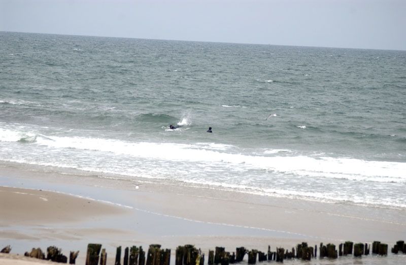
Rockaway Beach Restoration
After Hurricane Sandy, more than $140 million was invested to repair and restore Rockaway Beach. However, even with a successful beach season and better protected peninsula, the recovery of Rockaway Beach is only beginning. We are now working with the Rockaway community, NYC Economic Development Corporation (EDC) and US Army Corps of Engineers on a second phase of improvements – providing more long-term protection for Rockaway, constructing a new boardwalk, and developing a conceptual plan for further improvements to the area’s parks and facilities. Visit the Rockaway Beach Restoration page for more information about this project.
A New Partnership with the National Park Service
On July 17, 2012, the City of New York, the U.S. Department of the Interior, and the National Park Service signed an unprecedented agreement to cooperatively manage Jamaica Bay’s 10,000 acres of federal and City-owned public parkland. Under the agreement, City and federal agencies will jointly promote visitation, recreation, education programs, and scientific research, creating a new “jewel in the crown” of the national and City park systems.This innovative partnership will better connect surrounding communities to the natural beauty and history of Jamaica Bay. Visit our Jamaica Bay - Rockaway Parks partnership page for more information.
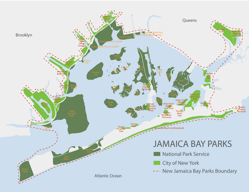
Boundary of the Combined Park
View this map to learn more about the open space and facilities that are included in the new Jamaica Bay Park partnership.
Jamaica Bay and the Rockaways comprises multiple National Park Service properties, contained in NPS' Jamaica Bay Unit . View the list of NPS properties in Jamaica Bay and Rockaway.
NPS Properties in Jamaica Bay and Rockaway
- Bergen Beach
- Breezy Point Tip
- Floyd Bennett Field
- Fort Tilden (beach closed)
- Frank Charles Park
- Hamilton Beach
- Jacob Riis Park
- Jamaica Bay Wildlife Refuge
- Plumb Beach (beach and bike path closed)
Jamaica Bay and the Rockaways comprises more than one NYC Parks property. To find out more information about an individual property, please choose from the following list of NYC Parks properties in Jamaica Bay and the Rockaways.
NYC Parks Properties in Jamaica Bay and the Rockaways
- Bay Breeze Park
- Bayswater Park
- Beach Channel Park
- Belt Parkway/Shore Parkway
- Brant Point Wildlife Sanctuary
- Broad Channel American Park
- Broad Channel Wetlands
- Canarsie Park
- Dubos Point Wildlife Sanctuary
- Flight 587 Memorial Park
- Four Sparrow Marsh
- Fresh Creek Nature Preserve
- Hook Creek Park
- Idlewild Park
- Jamaica Bay Park
- Marine Park
- McGuire Fields
- Paerdegat Basin Park
- Park
- Park at Beach 108 Street
- Rockaway Beach and Boardwalk
- Rockaway Community Park
- Seagirt Ave Wetlands
- Spring Creek Park
- Sunset Cove Park
- Tribute Park
- Tucker Place
- Vernam Barbadoes Peninsula
Show Disclaimer
Facilities
- Barbecuing Areas

- Baseball Fields

- Basketball Courts

- Beaches

- Bicycling and Greenways

- Bocce Courts

- Cricket Fields

- Dog-friendly Areas

- Eateries

- Fishing

- Fitness Equipment

- Football Fields

- Golf Courses

- Great Trees

- Handball Courts

- Hiking Trails

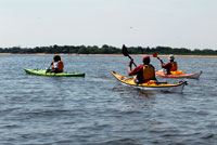
- Kayak/Canoe Launch Sites

- Marinas

- Model Aircraft Fields

- Nature Centers

- Paddleboat Rentals

- Pickleball Courts

- Playgrounds

- Public Restrooms

- Roller Hockey

- Skate Parks

- Soccer Fields

- Spray Showers

- Tennis Courts

- Volleyball Courts

- Wi-Fi Hot Spots

Featured Website
Go in-depth on all of the things to do and see in Jamaica Bay at nycgo.com, the official guide to NYC.
Highlights

Check out your park's Vital Signs
Clean & Safe
Green & Resilient
Empowered & Engaged Users
Share your feedback or learn more about how this park is part of a
Vital Park System![]()

Know Before You Go
Ecology Park is only open at certain times of year when Parks staff are present in order to protect this unique landscape. Want to visit? Check out our Stewardship Projects page for restoration, planting, and educational events.
Partner Organization

%7Cutmcsr%3D(direct)%7Cutmcmd%3D(none)%3B%2B__utmv%3D47330936.-%3B)