Resiliency Plans
An essential part of NYC Parks sustainability agenda, "park resiliency" is the ability of parks and open spaces to withstand and recover from disruptive events such as coastal storms and catastrophic flooding. Resiliency also refers to these parks' ability to withstand more gradual threats, such as sea-level-rise, associated with global climate change.
Planning for the long-term resiliency of our open spaces is a primary objective of NYC Parks. In addition to approaching capital projects for individual parks with a goal of increasing resiliency, the agency oversees a number of ongoing initiatives to support citywide resiliency measures. Key projects range from the creation of overall sustainability goals for planning and design of all New York City Parks to the establishment of a unique multi-party management structure for Jamaica Bay, one of the region's most ecologically valuable, and vulnerable, areas.
For more on overall sustainability practices at NYC Parks, visit our Sustainable Parks page.
Design and Planning for Flood Resiliency
This interdisciplinary manual provides background and guidance for developing and renovating coastally resilient waterfront parks. Design and Planning for Flood Resiliency: Guidelines for NYC Parks draws from NYC Parks’ decades of experience with waterfront park planning and design, and takes into consideration the valuable lessons learned after Hurricane Sandy. Released in November 2017, the Guidelines provide checklists for the planning and design processes specifically tailored for waterfront parks, examine different waterfront park types and recommend best practices for each, and suggest plants, materials, and design details best suited for coastal conditions.

High Performance Landscape Guidelines
High Performance Landscape Guidelines is NYC Parks' comprehensive manual for the design and construction of sustainable parks and open space, created in 2010 in partnership with the Design Trust for Public Space. The best practices in this manual inform the way New York City’s parks are designed, built, and maintained, ensuring that our parks clean our air and absorb storm water, reduce the urban heat island effect, provide habitat, and address the challenges of climate change.

Jamaica Bay Resiliency Planning
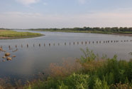
Jamaica Bay is a 22,000-acre wetland estuary that includes approximately 10,000 acres of parkland managed by the National Park Service and NYC Parks. Comprising an area almost equal to the size of Manhattan, the bay consists of numerous islands, a labyrinth of waterways, meadowlands, and two freshwater ponds. Enclosed by the Rockaway Peninsula and protected from the Atlantic Ocean, the region is an important ecological asset to the region, and is highly vulnerable to damage from coastal storms. The City, led by Parks, has a formal partnership agreement with the National Park Service to promote a cohesive vision for Gateway National Recreation Area and surrounding public properties that embodies an enhanced and seamless user experience offering an array of recreational and educational opportunities throughout the park. Key components of the partnership include a Wetlands Interpretive Center (currently in the conceptual planning stage), a Science & Resiliency Institute being planned in coordination with CUNY, and a General Management Plan for the park which will guide long-term decision-making over the next 20 years.

Rockaway Conceptual Plan
This neighborhood-scale conceptual plan addresses the agency's resiliency goals in the wake of Hurricane Sandy: to replace facilities lost from the storm, improve existing parks across the Rockaway Peninsula and Broad Channel, and create a long-term vision that enhances resiliency and community protection. The plan complements ongoing reconstruction efforts by integrating recreational facilities adjacent to the boardwalk and providing a broader vision for resilient parks and open space. The Conceptual Plan reflects extensive community input, including discussions with Rockaway and Broad Channel residents.
