Neighborhood Development Plans
In New York City, our parks are a key component of our neighborhoods and a crucial quality-of-life concern. NYC Parks works to ensure that quality, accessible open spaces are included in long-term plans for neighborhoods undergoing rezonings and other City-driven development. Parks works with the Department of City Planning and other agencies; the Mayor's Office; the City Council; borough presidents; private developers; and communities to create plans for new parks where opportunities exist. The agency also works with these stakeholders to develop management and maintenance strategies for new and existing parks within neighborhoods undergoing large-scale development. Parks has been an advocate for open space in dozens of neighborhood rezonings and development plans; a few recent examples are listed below.
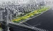
Greenpoint-Williamsburg Waterfront
The 2005 rezoning of the Williamsburg-Greenpoint waterfront stipulated the creation of over 50 acres of new parkland along the East River waterfront.
In response to community requests that these new parks be responsive to the needs of local residents, environmentally progressive, and designed in a consistent and inviting manner, the Parks Department created a waterfront master plan that serves as a guide for the agency and for future developers along the waterfront.
The master plan provides a conceptual framework for the 1.6-mile public esplanade that will be created by the rezoning plan, as well as schematic plans for new public parks along the waterfront.
Hunter's Point South
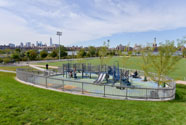
Hunter’s Point South is an approximately 30-acre new mixed-use neighborhood on the formerly industrial Long Island City, Queens waterfront that includes affordable housing, retail, open space and a new public school. Phase 1 of the development also includes the first phase of Hunter's Point South Waterfront Park, a state-of-the-art 5.5-acre waterfront park with new infrastructure, a central green, a playground, a waterfront promenade, a 13,000-square-foot pavilion, and a ferry dock for NY Waterway's East River ferry. An additional 5 acres of parkland will be built out as part of Hunter's Point South's Phase II development. NYC Parks continues to work closely with the NYC Economic Development Corporation, which is leading the development of the park and infrastructure at the site, and the New York City Department of Housing Preservation and Development, which will lead the development of new market and affordable housing adjacent to the Phase II park, on planning and maintenance efforts around these new open spaces.
Coney Island
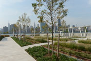
NYC Parks is now undertaking a long-term strategic plan for parklands and amenities at Coney Island. The plan addresses the need for major capital improvements, while also seeking new opportunities for maintenance and programming to improve the experience of visitors and residents.
Coney has been identified as a neighborhood in need of targeted City-led reinvestment in recreational amenities, shorefront protection, infrastructure, housing, and other major needs. The 19-block area surrounding the historic boardwalk and amusement park zone was rezoned in 2009 to encourage residential development, revitalize the historic amusement area, and create economic opportunities for Coney Island residents as well as South Brooklyn as a whole. This revitalization is ongoing; City reinvestment is expected to continue over the next decade and more as major new housing and infrastructure is developed. As the largest landholder in the Coney Island neighborhood, NYC Parks is a key player in the long-term planning for this revitalization, and is working closely with NYCEDC and other stakeholders on coordinated efforts in this area.
In 2012, Coney Island's beach and boardwalk were on the forefront of coastal inundation from Superstorm Sandy, and the area experienced widespread damage. Resiliency is a top priority for NYC Parks going forward, and is a key component of the Coney Island strategic plan.
Gateway Estates
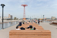
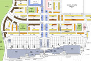
Gateway Estates is a 227-acre new mixed-use community near Spring Creek in East New York, Brooklyn. NYC's Department of Housing, Preservation and Development is the lead agency in creating plans for new affordable housing, retail, and infrastructure on the site. The development includes a 625,000 square-foot regional retail center, affordable housing for nearly 7,000 people, more than 100 units of housing for seniors and a public school. Parks are a major component of Gateway Estates: the development is adjacent to the 55-acre Spring Creek Park, and there are three small neighborhood parks included in the plan. NYC Parks is overseeing the design and planning of these parks in coordination with HPD and other City agencies.
East Midtown Waterfront Greenway
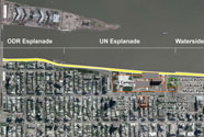
Along with the NYC Economic Development Corporation and other City, State and federal agencies, NYC Parks is coordinating to build a new public esplanade along the East River in Midtown Manhattan. This mile-long walkway and bikeway would run from 38th Street to 60th Street, creating a vital open space connection in this dense neighborhood with very few parks. Planning for the greenway is being coordinated with a major new park project at Waterside Pier, the conversion of nearby Asser Levy Place into a park, and the planned expansion of the United Nations campus.
East River Waterfront Esplanade
NYC Parks has been a key player in the community-driven design and planning process for the East River Waterfront Esplanade since the project began in 2004. The $165 million project to revitalize a stretch of City-owned waterfront includes a two-mile walkway and bikeway that connects to the larger Manhattan Greenway, and a series of new open spaces. A section of the park stretching from the Battery Maritime Building to Maiden Lane, and including the repurposed Pier 15, is now open. A final phase, stretching from Maiden Lane to just north of the Manhattan Bridge, and including a repurposed Pier 35, is slated to open in 2014.

East Side Coastal Resiliency
The East Side Coastal Resiliency Project (ESCR) is an integrated coastal protection system that aims to not only reduce the risk of flooding, but also facilitate access to the waterfront, create improved public spaces and enhance natural areas. As the project moves from concept to implementation, NYC Parks will continue to take a lead role in advocating for developing resilient open spaces.
