Before They Were Parks
Pick any public park, and it has a story to reveal about what it once was and how it came to be. It may be lush and green now, but at some point in its past it might have been a warehouse, tenement, estate, reservoir, landfill, cemetery or jail. The route from private ownership to public amenity is typically long and arduous. Here we feature a fraction of the countless scenarios that have marked the city’s never–ending quest for parkland in a densely built metropolis.
An exhibit on this subject was on display in the Arsenal Gallery from June 23, 2010–September 9, 2010.
Select a borough:
Queens
Clearview Expressway / Clearview Park and Golf Course, Queens
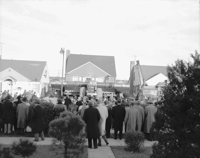
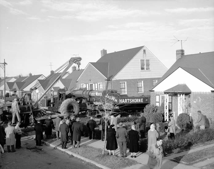
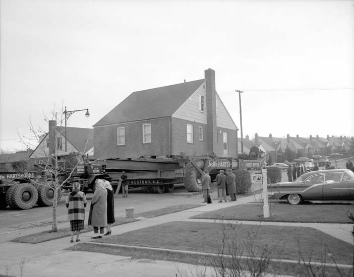
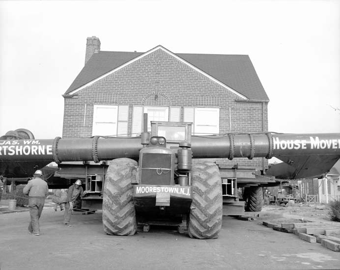
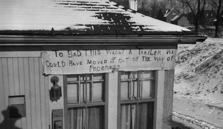
The land around the Clearview Expressway in Bay Terrace, Queens was owned by three influential families before being bought in 1823 by Charles Willet. In the mid–nineteenth century, many more wealthy New York families built mansions in Bayside. In the 1920s and 1930s, many of these estates were dissolved to make way for new residents. Bayside saw significant post–war construction of bridges and highways, as with the Clearview Expressway. Built between 1957 and 1963, the expressway connects the Throgs Neck Bridge with major east–west traffic arteries of Queens and Long Island. When the plans were made public, locals protested that the project would negatively affect their neighborhoods, and a compromise was reached in which a much smaller number of homes were relocated to a new neighborhood built on the site of the Bayside and Oakland Golf Courses. The Triborough Bridge and Tunnel Authority overseeing the expressway’s construction also acquired a portion on the east side of the Clearview Golf course as a right of way.
Click on an image to view a larger size and more information
Learn More about the Expressway
Learn More about the Park and Golf Course
Elmhurst Park, Queens
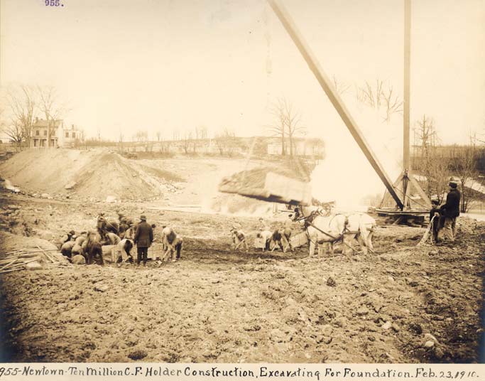
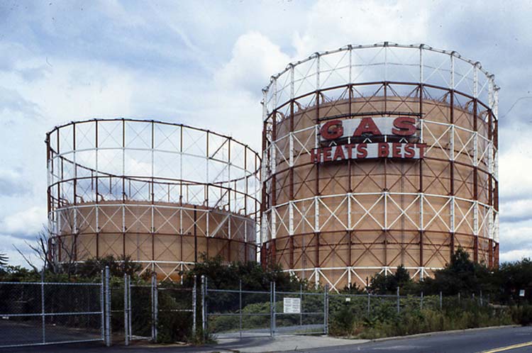
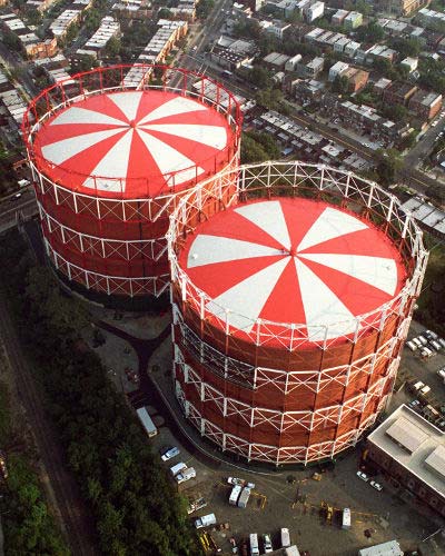
Currently being converted to a new park, this land was previously used for apple orchards, though it is better known as the former home of the Newtown Holder Station (colloquially known as the Elmhurst Gas Tanks.) The tanks, familiar to locals as well as millions of motorists traveling on the nearby Long Island Expressway, were built separately in 1910 and in 1921. Horse and steam powered equipment helped excavate the large pit that accommodated the tanks. In 2001, KeySpan Energy Corporation (formerly Brooklyn Union Gas, and now NationalGrid) sold the famous Elmhurst Gas Tanks site to the City for one dollar, and the property was designated for a new community park six acres in size.
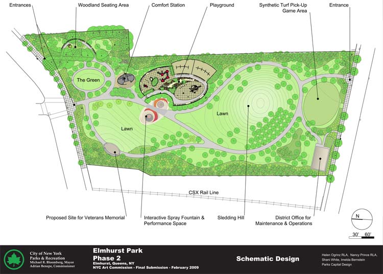
The removal of the gas tanks presented a tabula rasa for a new park design. After a period of community input the park began to take shape in 2008. A first phase of work graded the park with new top soil and planted 500 disease-resistant trees. A second phase of construction will be complete by fall 2010. The northeast corner incorporates existing mature trees into woodland areas enhanced with ferns and a sea of bluebells. Winding paths and various elliptical spaces (evoking the footprint of the gas tanks) permit seating areas for the elderly and active spaces for children. Play equipment with a silver and red hue recall the gas tanks. A perimeter screen of evergreens will mask the industrial neighbors from the park’s interior. Newtown Pippen apple trees remind visitors of the former orchard at this site, and new saplings of oak, beech and sweet gum are expected to grow into majestic shade trees.
Click on an image to view a larger size and more information

Flushing Meadows–Corona Park, Queens
Now Queens’ largest park, Flushing Meadow was at one time a pristine tidal estuary and wetland through which the Flushing River wound until emptying into the bay. By the twentieth century the marshland had been severely compromised through decades of industrial activity and dumping, famously described by F. Scott Fitzgerald as a “valley of ashes.” In the 1930s city booster and businessman Grover Whalen and Parks Commissioner Robert Moses decided to convert this area to public parkland and used it as the World’s Fair Ground in 1939–40; the site hosted a second World’s Fair in 1964–65. The structures that remained from the two fairs became the foundation for the growing park, and the Unisphere — left from the 1964 Fair and designated as a city landmark — has become the park's well–known symbol.
Click on an image to view a larger size and more information


Newtown Playground, Queens
As early as 1730, the land now comprising Newtown Playground was used as a cemetery. Some of Newtown’s most prominent residents were buried here, including members of the Moore and Fish families, successful fruit growers and farmers. The land was transferred to the Department of Parks in 1917. The 1927–28 Queens Annual Report noted that “[a]ll the old headstones, which stuck up like eyesores, were laid flat and covered with soil.” Newtown Playground was fully developed as a playground in 1934–35.
Southern Parkway, Queens
The Southern Parkway was established in a sparsely populated stretch of land previously used as a right of way for the Brooklyn water supply system. Stretching 25.9 miles, the parkway was built in phases between 1927 and 1949. Though its construction displaced far fewer residents than projects such as the Cross–Bronx Expressway, it was not without its downside, and affected a number of “one and two family homes” described by park officials as “of a poorer class.” The first section of the parkway, from Central Avenue to Peninsula Boulevard, was completed in 1927, with the road reaching Moses’ most famous state park, Jones Beach, in 1929. From its inception, the Southern State Parkway incorporated many new and innovative engineering designs, such as grade separation and cloverleaf interchanges. The road would reach its proposed eastern terminus, Bay Shore Road in Suffolk County, by 1949.
Related Links
Parks History Historical Signs Capital Projects Park of the Month
%7Cutmcsr%3D(direct)%7Cutmcmd%3D(none)%3B%2B__utmv%3D68801786.-%3B)