Before They Were Parks
Pick any public park, and it has a story to reveal about what it once was and how it came to be. It may be lush and green now, but at some point in its past it might have been a warehouse, tenement, estate, reservoir, landfill, cemetery or jail. The route from private ownership to public amenity is typically long and arduous. Here we feature a fraction of the countless scenarios that have marked the city’s never–ending quest for parkland in a densely built metropolis.
An exhibit on this subject was on display in the Arsenal Gallery from June 23, 2010–September 9, 2010.
Select a borough:
Brooklyn
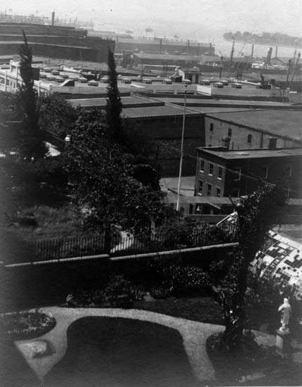
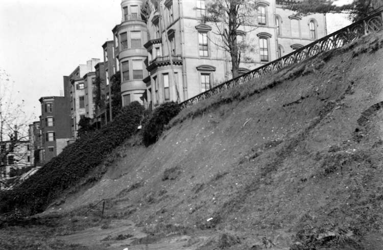
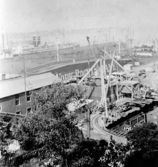
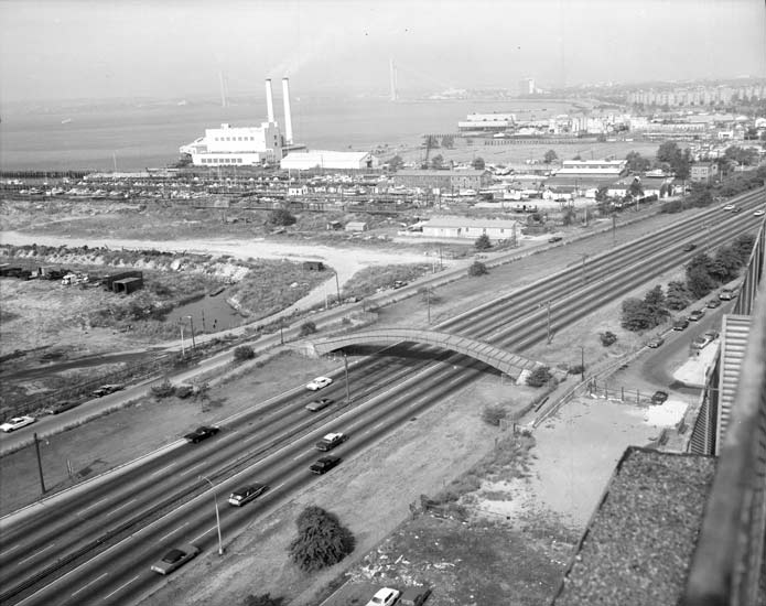
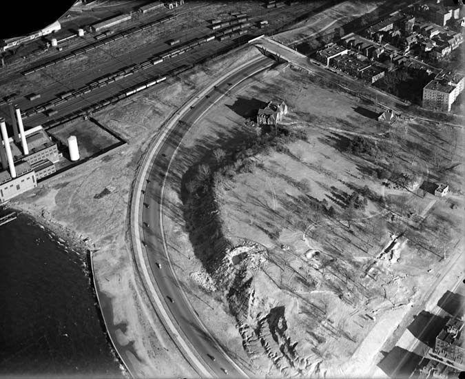
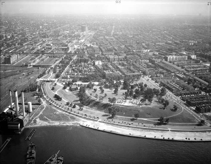
Brooklyn Heights Promenade, Brooklyn
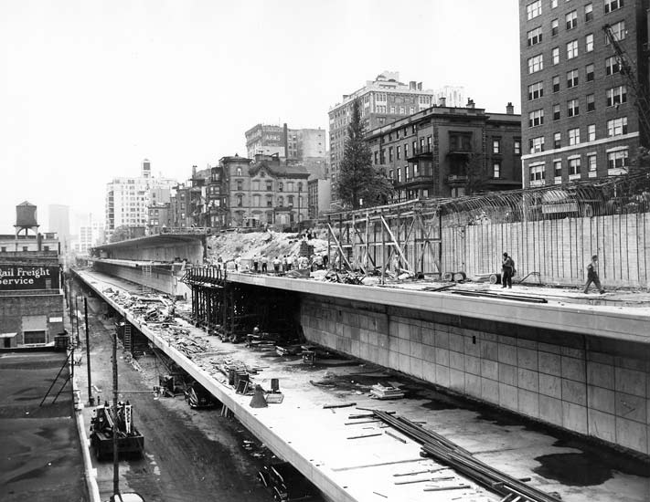
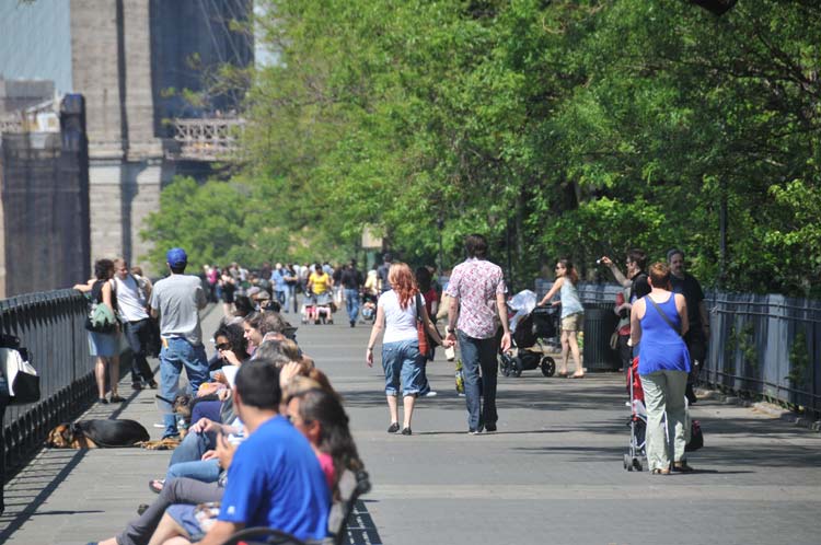
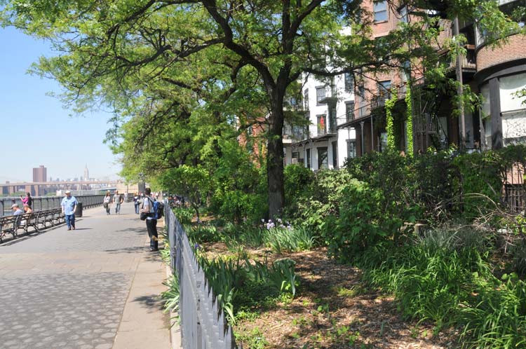
One of the oldest neighborhoods in New York City, Brooklyn Heights was designated the city’s first official landmarked historic district in 1965. The townhouses along Columbia Heights, built in the 1820s, possessed extensive private backyard gardens at the top of a steep embankment with famously impressive views of New York Harbor, the Manhattan skyline, and the industrial Brooklyn waterfront. As early as 1825 Hezekiah Pierrepont, a prominent landowner and the “father” of Brooklyn Heights, suggested a public promenade that would take advantage of the spectacular views from the embankment and eastern ridge. His ideas were achieved in 1941 when the city proposed building the Brooklyn–Queens Expressway (BQE) through Brooklyn Heights. Community opposition led to a compromise in which a double–decker highway was built on the neighborhood’s edge, and the new public promenade opened in the 1950s.
Dreier–Offerman Park (Calvert Vaux Park), Brooklyn
Dreier–Offerman Park, now Calvert Vaux Park, has been in a constant state of flux for almost eighty years. The earliest parcel of land was acquired by the city in 1933, donated by the Dreier–Offerman Home for unwed mothers and their children. By 1941, an elegant pedestrian overpass was built over Shore Parkway (the “Belt”), but it remained essentially a “bridge to nowhere,” linking only the narrow pedestrian walkway and bicycle path. Two more parcels of land were acquired in 1962, but for years the area remained largely unimproved for public use, marred by illegal dumping, rimmed by industrial uses and even used as a manure farm. It wasn’t until the 1990s that the park finally began to come together, due to the reconstruction of a limited play area and the introduction of several ballfields in the late 1980s and cleanups organized by local volunteers. The park was renamed in 1998 to honor Calvert Vaux, the noted landscape architect and co–designer of Central Park, who drowned in mysterious circumstances in the nearby bay in 1895. In 2009 a $40 million upgrade began through PlaNYC, a mayoral initiative, and includes among other things a restored waterfront, soccer and baseball fields, an amphitheater, and new nature trails.
Fort Greene, Brooklyn
You might not think of it while lounging on a blanket, but Fort Greene Park's high vantage point suited it well for a military installation. Indeed, it was one during both the Revolutionary War and the War of 1812.
In 1776, American Major General Nathanael Greene, for whom Fort Greene Park is named, supervised the construction of Fort Putnam on high ground that is now part of Fort Greene Park. The fort was renamed for General Greene and rebuilt for the War of 1812. When the threat of war passed, locals enjoyed visiting the grounds of the old fort for recreation and relaxation, and the City of Brooklyn designated the site a public park in 1845.
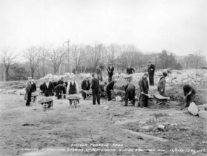
Lincoln Terrace Park, Brooklyn
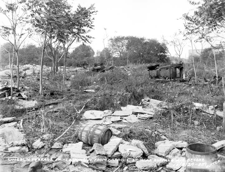
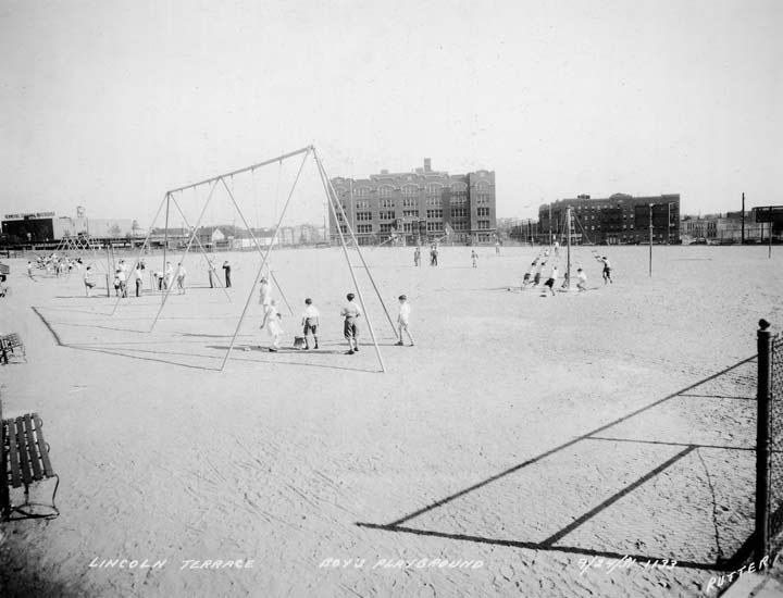
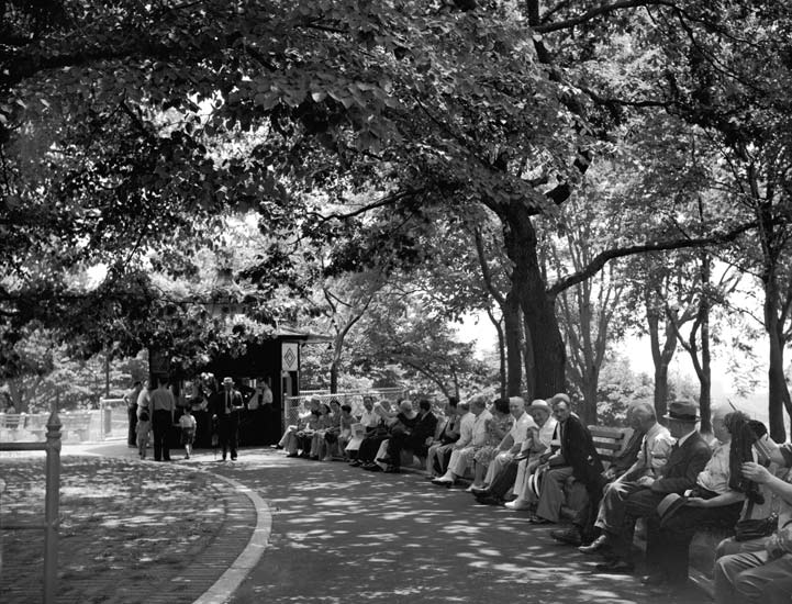
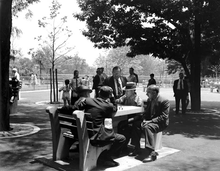
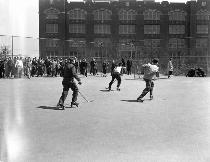
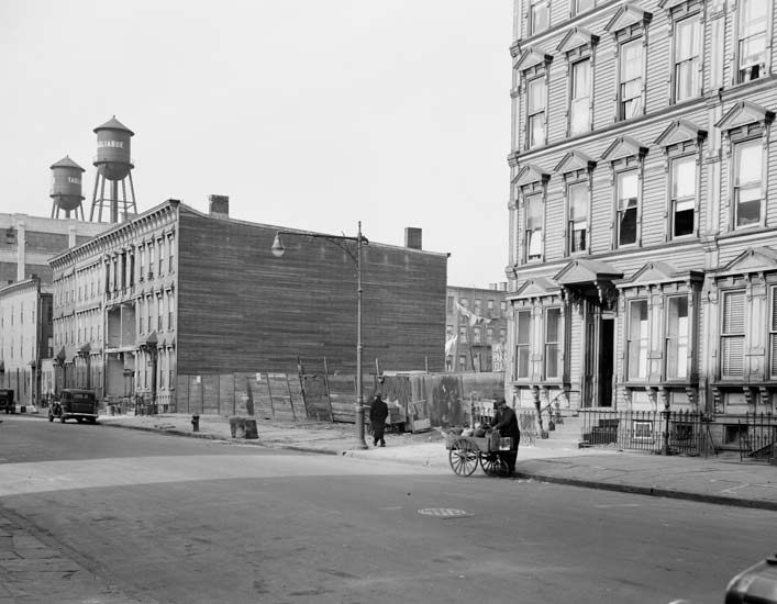
When its earliest portions were acquired by the city in the 1890s, Lincoln Terrace Park consisted of bucolic rolling hills evoking the countryside. By the late 1920s, however, the site remained overlooked and had become a derelict dumping ground. In the depth of the Great Depression, out–of–work men were given employment through the Federal Works Progress Administration (WPA) and engaged in making or restoring public works. Lincoln Terrace Park, at 21 acres, was so large that improvements were completed in phases of construction implemented over several decades, though most of the work occurred in the 1930s. Another series of improvements occurred in 1996, which added many recreational facilities. Today the park, which straddles the communities of Brownsville and Crown Heights, supports a variety of recreational uses from basketball, handball and roller hockey to more passive pastimes such as chess.
Click on an image to view a larger size and more information
Marcy Playground, Brooklyn
An unnamed park preceded this playground that was named in honor of William Learned Marcy, a lawyer, soldier, and statesman. It was located a block further north, was one–third the size of Marcy Playground, and held a flagpole with a monumental base dedicated to Samuel V. Crews, a veteran of World War I. In 1945, New York City purchased 28.5 acres of land for the Marcy Houses development. As part of the Marcy Houses design, the existing playground would be relocated. According to the final New York City Housing Authority plan, dated June 26, 1946, 3.2 acres were set aside for a park within the development; the base of the flagpole from the previous park was moved to the new location. Marcy Playground was reconstructed in 1989, and a half–court and a regulation full court were added for basketball. The playground includes benches, game tables, a baseball diamond, spray showers, play equipment with safety surfacing, basketball hoops, swings for tots and children, picnic tables, and the flagpole, with its monumental base and a yardarm.
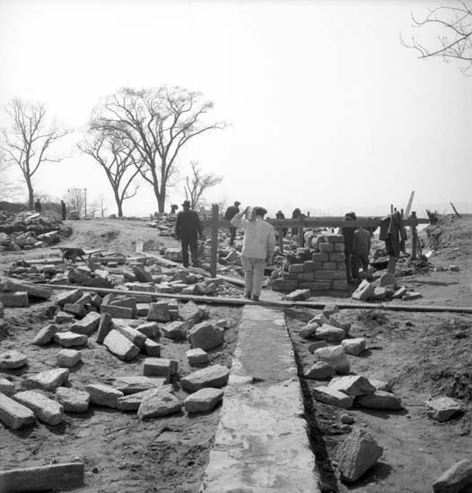
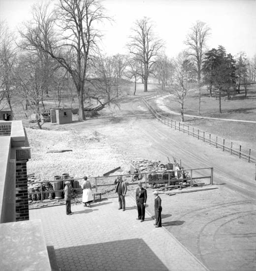
Owl’s Head Park, Brooklyn
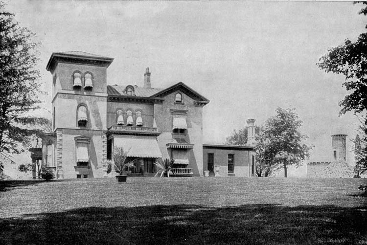
The Canarsie Indians and early Dutch settlers once fished along the shore and farmed the fertile soil that is now Owl’s Head Park. Henry C. Murphy, an Irish–American who held many political positions, including Mayor of Brooklyn and United States Congressman, built a mansion on the glacial ridge overlooking the harbor. In 1866 Eliphalet W. Bliss, a wealthy manufacturer, bought the estate and renovated the mansion, adding a horse stable and observatory tower known as “the castle.” In his will Bliss, who died in 1903, offered his property to New York City for less than its true value stipulating that it only be used for parkland, and in 1928 the Bliss estate was officially designated a public park. Though impressive at the time the City it, the land and structures fell into neglect with the onset of the Depression. Between 1934 and 1937 Federal funding helped convert the estate into a scenic park, incorporating the extensive collection of established trees and adding paths, playgrounds and play fields, park houses, and a seating plaza that took advantage of the magnificent vista from its southwesterly perimeter. A 2002 renovation of the park restored the historic Bliss gate that had been salvaged decades before.
Click on an image to view a larger size and more information
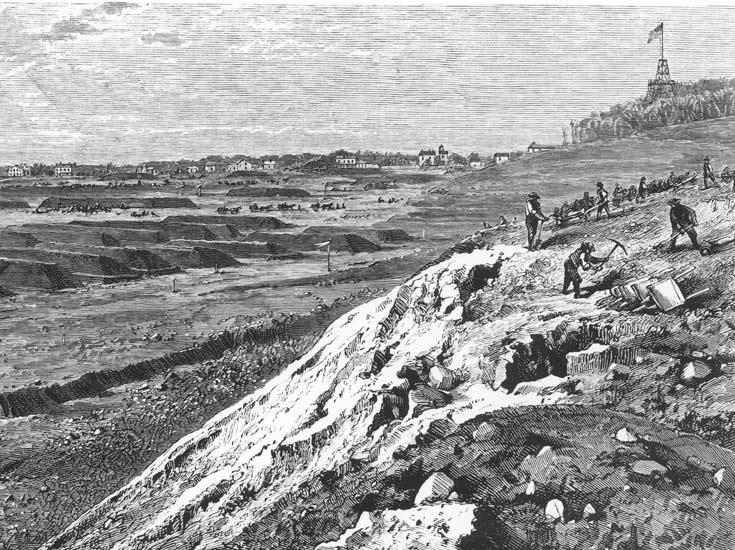
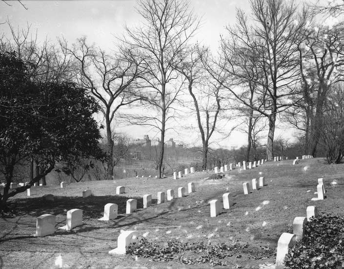
Prospect Park and Friends Cemetery, Brooklyn
One of the major early battles of the Revolutionary War was fought in Prospect Park in August 1776. In fact, the topography of Battle Pass, which is located on the east side of the park along the park drive, looks much the same as it did when George Washington’s Continental Army forces dug in against British and Hessian soldiers moving up from the south, eventually forcing Revolutionary troops to retreat in defeat. Several monuments that honor the events of the Revolutionary War were erected in the park, including Battle Pass Historic Marker, Dongan Oak Marker, and the Maryland Memorial.
Between 1860 and 1866 various State legislative acts established the boundaries for Prospect Park, designed by Frederick Law Olmsted and Calvert Vaux, who also designed Central Park. When the location of the park shifted, the Religious Society of Friends (commonly known as Quakers) Cemetery, established in 1849, found itself inside the park’s boundaries. Rather than relocating the congregational burial ground, the Quakers were permitted to retain approximately 100 acres, and were guaranteed passage to and from the cemetery. It is today ten acres in size and is still in active use by members of the New York Quarterly Meeting of the Religious Society of Friends.
Click on an image to view a larger size and more information
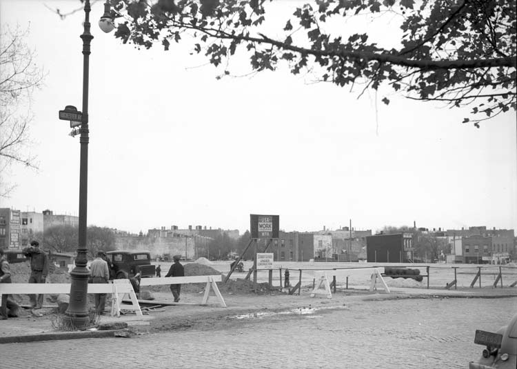
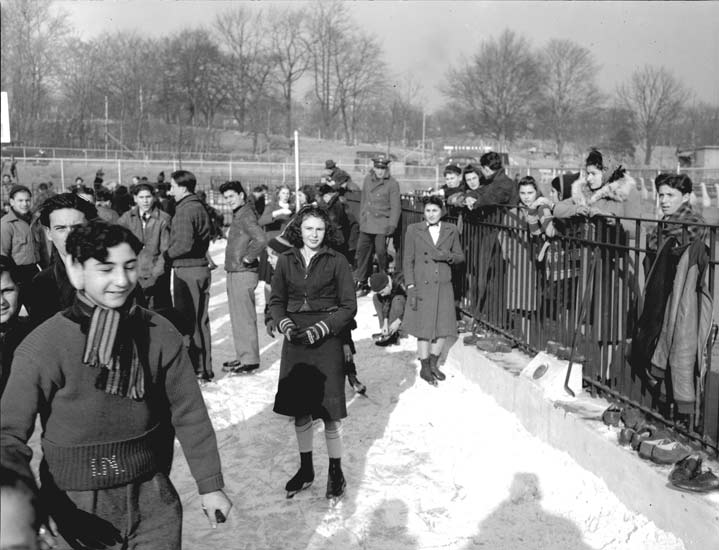
St. John's Recreation Center, Brooklyn
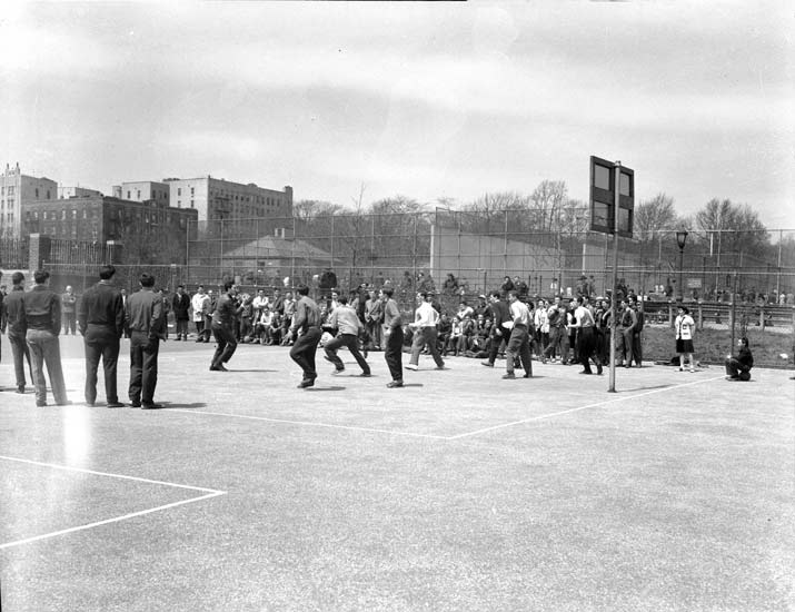
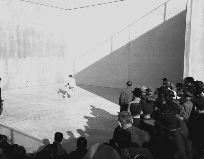
The land that became St. John’s Park was acquired by the City in 1950, and shortly thereafter the stretch of St. Mark’s Place that ran between Schenectady and Troy Avenues was eliminated in order to create more parkland with the intention of eventually building a recreation center at the site. St. John’s Recreation Center, completed in 1956, was the third year–round center opened as part of Parks Commissioner Robert Moses’s idea to open recreation centers as a way to provide positive outlets for children in disadvantaged communities, and thus improve social conditions. The first phase of Moses’s vision for the park, its outdoor component, included three softball fields and a comfort station. It was completed in 1953 to serve the 800–unit Albany Houses complex, which later took in tenants displaced by the construction of the park. Outdoor basketball and handball facilities were added in 1955.
Click on an image to view a larger size and more information


Related Links
Parks History Historical Signs Capital Projects Park of the Month
%7Cutmcsr%3D(direct)%7Cutmcmd%3D(none)%3B%2B__utmv%3D74318931.-%3B)