Grand Ferry Park
Grand Ferry Park
This text is part of Parks’ Historical Signs Project and can be found posted within the park.
Grand Ferry Park was a ferry landing that served the burgeoning populace of Williamsburg before it became part of Brooklyn. It is named for the 19th century Grand Street Ferry, which once carried farm goods and passengers across the East River to Manhattan.
In 1802, Richard Woodhull, spurred by the idea of creating a residential suburb of Manhattan, began a ferry service from present-day Metropolitan Avenue in Brooklyn to Corlear’s Hook on the Lower East Side of Manhattan. Woodhull purchased 13 acres of land surrounding the ferry landing with a plan to build homes and, in 1810, named the area ‘Williamsburgh’ after Colonel Jonathan Williams (1750-1815), the original surveyor of the site.
In 1806 Woodhull went bankrupt, but the idea of Williamsburgh persisted; Noah Waterbury built the neighborhood’s first distillery in 1819, and David Dunham, called the “Father of Williamsburgh,” began operating a steam ferry in 1818. During the mid-1800s, wealthy professionals frequented the private clubs, beer gardens, and resorts that inhabited the neighborhood, while companies like Pfizer Pharmaceutical and the Havermeyers & Elder Sugar Refineries (now Domino Sugar) established themselves here along the water.
By 1852, Williamsburgh’s population had grown to 31,000 and it was chartered as a city. The City of Brooklyn annexed Williamsburgh three years later and dropped the “h” from its name. The opening of the Williamsburg Bridge in 1903 provided an easy route for the city’s newest Eastern European immigrants to leave the cramped Lower East Side of Manhattan and by 1917 Williamsburg had become the most densely populated area of Brooklyn.
The Grand Street Ferry ceased operations in 1918, and the abandoned landing became one of the few stretches of Williamsburg’s shoreline accessible to the public. In 1974, the Parks Council, an advocacy group, created an unofficial park in the space using recycled materials; later the land was acquired by Parks in order to ensure its permanence as a park, and sufficient funding for its repair and maintenance. The 1.55 acres of land was transferred to Parks on October 1997.
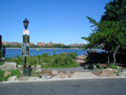
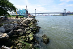
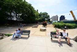
The new park, located between Grand Street, West River Street, and the East River, officially opened on July 9, 1998. The design incorporates elements from the site’s history. A red brick smokestack rising above a circular pattern of cobblestones was part of a molasses plant that Pfizer Pharmaceuticals used in the early 20th century for work that led, eventually, to the large-scale production of penicillin. The cobblestones were salvaged from the section of Grand Street where the park was constructed.
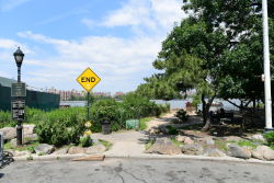
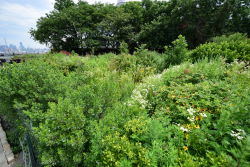
In 2008, the park landscape was reconstructed with new plantings, paths and drainage. This project was funded in part by the New York State Power Authority, in connection with their new plant just north of the park. As part of the wetlands requirements for this waterfront parcel, mandated by the Department of Environmental Protection, these new plantings show an emphasis on native species of trees, shrubs and perennials. Native tree species include varieties of dogwood (Cornus), American holly (Ilex opaca) and river birch (Betula nigra).
Native shrubs range from beach plum (Prunus maritima), bayberry (Myrica pennsylvanica) and red chokeberry (Aronia arbutifolia) to viburnums (Viburnum) of several varieties. These native species were chosen for their ability to withstand the wetlands, brackish air and windgusts of this littoral environment.
Several jagged Shore ‘Pitch’ Pines (Pinus contorta) from an earlier landscape design also mark the landscape, together with honey locusts (Gleditsia triacanthos inermis) and White Ash (Fraxinus americana) which bring shade and elegant leafage to the site.
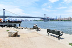
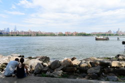
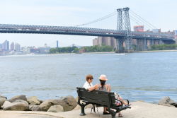
At the water’s edge, a line of boulders, or rip-rap, protects the shoreline from erosion and provides seating with a view across the water to the downtown Manhattan skyline. On one side of the park’s slope, a trench lined with rocks stretches from Grand Street to the water. When storms flood the street, this trench or ‘swale’ serves to direct the stormwater runoff into the river. The swale has been landscaped as a streambed, with varieties of native plants along its perimeter, including the cinnamon fern (Osmunda cinnamonea), the Christmas fern (Polystichum acrosticoides) and switchgrass (Panicum virgatum).
Check out your park's Vital Signs
Clean & Safe
No recent capital investment.
Green & Resilient
39
Mapped Trees
No natural areas present at this site.
Empowered & Engaged Users
No recent or upcoming events.
No active volunteer groups.
Share your feedback or learn more about how this park is part of a
Vital Park System

