This text is part of Parks’ Historical Signs Project and can be found posted within the park.
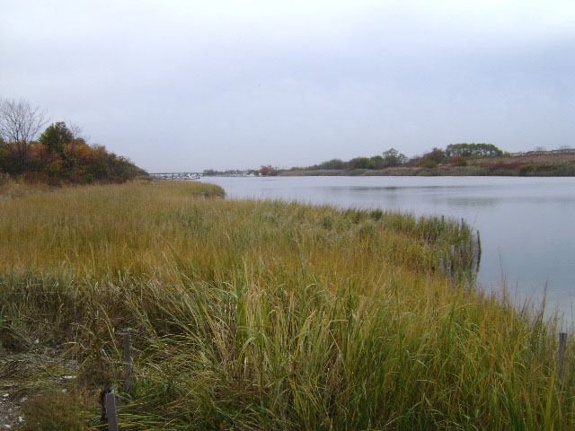
This marshy East Flatbush park comprises a 1.25-mile channel that empties into Jamaica Bay in nearby Bergen Beach. Paerdegat Basin, whose name means “horse gate,” in Dutch is a saltwater wetland area.
Paerdegat Basin is surrounded by two neighborhoods that were developed in the 1960s. Both communities, Georgetown (to the west) and Paerdegat Basin (to the east), are small, designated parts of larger neighborhoods. Georgetown is officially part of Bergen Beach, and Paerdegat Basin of Canarsie.
Show Disclaimer
This map is designed to represent parks as they are used by the public. It should not be used to represent the legal boundaries of property under Parks jurisdiction. If you would like to view all City property under the jurisdiction of NYC Parks, please visit NYC OpenData.


Check out your park's Vital Signs
Clean & Safe
$30.5M
Recent Investment
Green & Resilient
46
Mapped Trees
Empowered & Engaged Users
No recent or upcoming events.
Share your feedback or learn more about how this park is part of a
Vital Park System![]()

Know Before You Go
Ecology Park is a five acre site set within Paerdegat Basin Park. The goal of the park is to promote habitat restoration and ecological improvement, highlighting fourteen native plant community types that exist or once existed in New York City.
Ecology Park is only open at certain times of year when Parks staff are present in order to protect this unique landscape. Want to visit? Check out our Stewardship Projects page for restoration, planting, and educational events.
Ecology Park is only open at certain times of year when Parks staff are present in order to protect this unique landscape. Want to visit? Check out our Stewardship Projects page for restoration, planting, and educational events.
 |
%7Cutmcsr%3D(direct)%7Cutmcmd%3D(none)%3B%2B__utmv%3D73093270.-%3B)