Hot Rocks: A Geological History of New York City Parks
To learn more about the Parks-rocks connection be sure to read the companion piece, Parks Monuments and Geology.
Introduction

Click on images in the article
for a larger view.
Although New York City is known around the world for its manmade wonders, the region has its own interesting geologic features that are no less monumental. From its ancient bedrock to fault zones that cut across the city to its geographic position at the edge of a glacier, the geologic history of the city can be found in its parks.
New York City's geology has influenced—and impeded—the landscape design of its parks, from the natural schist outcroppings that Olmsted & Vaux took advantage of in shaping Central Park to the placement of the band of parkland running through Brooklyn and Queens. Both early and modern park designers have incorporated natural geologic elements into their designs, as with much of Central Park’s general terrain, or individual features within the park such as the slide built into a schist embankment at the park's Billy Johnson Playground. Natural rock outcroppings like those at Central Park are also prominent features at St. Mary's and Claremont Parks in the Bronx, Morningside Park in Manhattan, and elsewhere across the five boroughs.
Building around Bedrock
“Bedrock” is the solid rock below loose surface material, and New York City has several major bedrock features—the evidence of which can be found in parks across the city. The bedrock in the city ranges in age from 1.1 billion to 190 million years old, and the rocks we see at the surface are the roots of an ancient mountain chain worn down over millions of years by the forces of erosion. Significant bedrock types and features include Fordham Gneiss (visible at Van Cortlandt Park, especially around Vault Hill north of the Parade Ground and an exposed section overlooking the Harlem River Ship Canal across from Inwood Hill Park, most notable for the giant “C” painted by Columbia students), the Hartland Formation (seen at Pelham Bay Park), Manhattan Schist (with many examples in Central Park and in Upper Manhattan at localities like Bennett Park), and Inwood Marble (as in Isham Park in Upper Manhattan). Of these, Fordham Gneiss is the oldest, over one billion years old.
Shaky Ground? Mapping Local Fault Lines

Although the eastern part of North America is not necessarily known for its earthquake activity, there are fault zones throughout the region (although not all earthquakes occur in fault zones). Three major ancient fault lines in the New York City area run through parks: the Mosholu Fault in Van Cortlandt Park in the Bronx, and the 125th Street and Dyckman Street Faults in Upper Manhattan. The 125th Street Fault and the Dyckman Street Fault are both notable in that they actually help form the boundaries of parks in Upper Manhattan: the “valleys” that split Riverside Park and separate Fort Tryon and Inwood Hill Parks are really the 125th Street Fault and Dyckman Street Fault, respectively.
Remnants of an Ice Age
The Wisconsin Ice Sheet, the last of many glacial advances that grew after the start of the Pleistocene Era about 1.5 million years ago and which stretched down from eastern Canada (Labrador), advanced as far south as New York City. The Wisconsin Ice Sheet left its marks on the city, depositing rock and debris and accounting for the hilly areas that run straight through the middle of the five boroughs. Geologists believe that the Wisconsin Ice Sheet began its southward journey from Labrador about 90,000 years ago and reached its maximum about 70,000 years ago, forming the Ronkonkoma Moraine on Long Island. During a period of warmth and retreat, it advanced again starting about 45,000 years ago, reaching New York City about 20,500 ago, forming the Harbor Hill Moraine and beginning its retreat about 18,000 years ago.
In New York City, the Wisconsin Ice Sheet was 1,000 feet thick (in the Adirondacks it was over 5,000 feet thick and perhaps as much as 10,000 feet thick in Labrador). The Wisconsin Ice Sheet had an impact not only on New York City but also farther north, deepening the bed of the Hudson River Valley (the Hudson River is the southernmost glacial fjord in the Northern Hemisphere), carving out the Great Lakes and the Finger Lakes basins, and leaving its mark on the Adirondack mountains. The glacier also deepened valleys beneath Webster Avenue in the Bronx, and the Harlem and East Rivers. It smoothed the bedrock and left glacial grooves and striations as the advancing glacier dragged rocks over the surface.
The Wisconsin Ice Sheet Continues Its Journey
The nature of glaciers is that as they grind away at rock underneath them, the rock gets picked up and travels along with the glacier. After the glacier melts, the rock debris is left behind. In the New York region, the Wisconsin Ice Sheet deposited tons of gravel, pebbles, and sand—moving, for example, boulders from the Palisades to Central Park—plowed up topsoil, and leveled the earth, filling in depressed areas with glacial till. Even after the Wisconsin Ice Sheet stopped advancing south and its southern end was melting at the same rate that the ice advanced, it meant that rock debris was deposited and piled up at the southern edge of the ice sheet. This feature is known as a “terminal moraine” and evidence of it (hundreds of feet high in some places) stretches from the southern end of Staten Island across the Narrows and through Brooklyn and Queens. Graniteville Park on Staten Island is situated in a community that makes direct reference to the geologic deposits that were quarried for trap rock from the 1840s to the 1890s.
Glacial Erratics
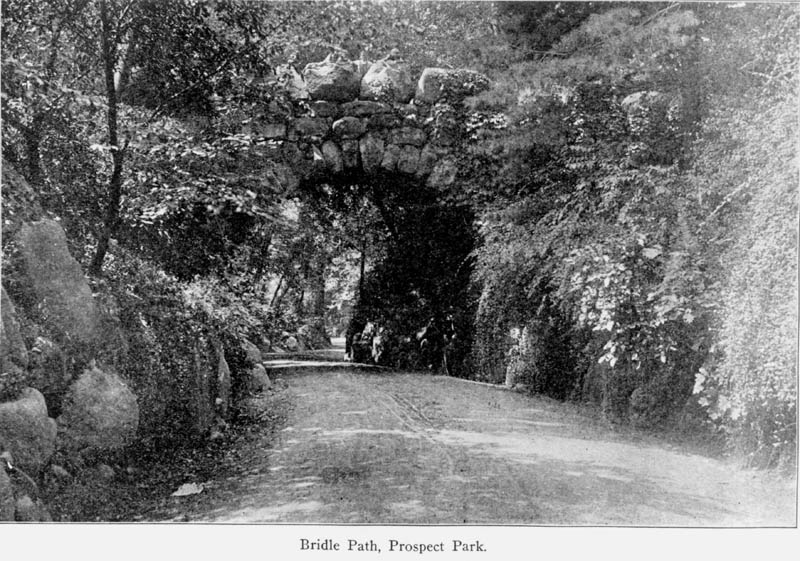
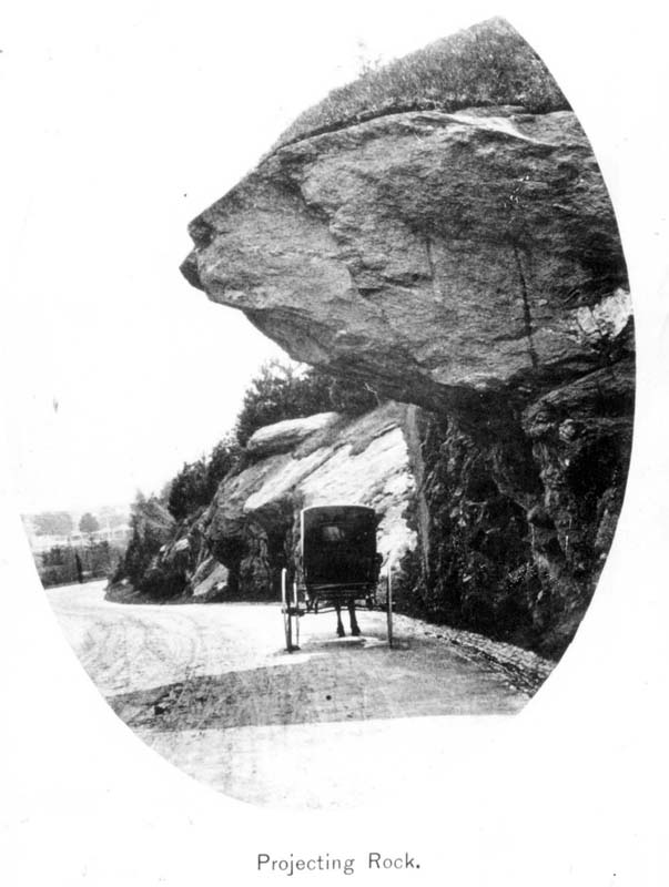
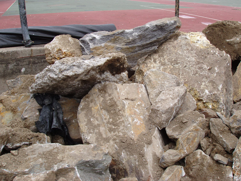
Without the terminal moraine, most of Long Island, including Queens and Brooklyn, would lie beneath the Atlantic Ocean, since the bedrock of Long Island is largely below sea level. In addition, the huge amounts of sand, silt, and clay that form the five-mile-wide outwash plain that lies under Flatbush, Coney Island, and Canarsie were deposited by streams from the melting glacier. Individual stray rocks called “glacial erratics” were rounded by the glacier and left behind after the ice melted away. Today these rocks are found across the city. Boulder Bridge in Brooklyn's Prospect Park is made of glacial erratic, and the large boulders recently unearthed in Fort Greene during sewer construction are also examples of glacial erratics—one Fort Greene rock weighing several tons and perhaps as much as 565 million years old will be relocated to a new park in Elmhurst, Queens.
Use of Terminal Moraine
The rocky terminal moraine areas meant that they were the least suited for development, and thus the cheapest lands for the city to use for woodlots, cemeteries, and especially for parks. The band of green across Brooklyn and Queens, from Highland Park to Forest Park, including the many cemeteries in this area, is all built on the terminal moraine. In Brooklyn, Greenwood Cemetery and Prospect Park also comprise a portion of the terminal moraine, and the terminal moraine is even referred to in the names of neighborhoods across this strip: Bay Ridge, Greenwood Heights, Windsor Terrace, Prospect Heights, Crown Heights, Highland Park, Cypress Hills, Ridgewood, and Forest Hills all lie along the terminal moraine.
As if to prove that rocky, hilly terrains are only suitable for parks, it is interesting to note that with the exception of the Bronx, the high points of each borough are in parks: Bennett Park in Manhattan, Todt Hill in Staten Island, and in parks such as Highland Park and Forest Park along the terminal moraine in Brooklyn and Queens. These ridges and peaks provide stunning views of the city, and park designs from Sunset Park and Owl’s Head Park in Brooklyn to Fort Tryon and Inwood Hill Parks in northern Manhattan have taken advantage of these vistas in intricate networks of pedestrian paths and terraces.
Marcus Garvey Park
Too impractical to level, the large outcropping of Manhattan Schist in Harlem at Fifth Avenue between 120th and 124th streets became a key part of the park system in this part of Manhattan. Fifth Avenue traffic was diverted around the square, and an elegant district of row houses emerged around the park. (Marcus Garvey Park's high “Acropolis” was also useful for a Fire Watch Tower at a time when many wooden buildings existed in Manhattan and fires posed a problem.)

Proposal for Tunnel through Mount Morris Park, Manhattan. Graphite rendering, 1936. Collection of City of New York, Parks & Recreation, Map File.
In 1922, the Harlem Board of Trade first floated the concept of a tunnel through the rock as a way of speeding vehicular traffic along Fifth Avenue. Parks Commissioner Robert Moses took up the idea in the early 1930s, and his architectural team designed grand staircases and terraces at the park's entrances. The plan never advanced off the drawing board.
Creative Use of Geological Features

Seton Falls Park, a former estate acquired in 1914, is distinguished by a waterfall created through the damming of Rattlesnake Creek. Also in the Bronx, Richman Park was once known as Echo Park for the distinctive sound reverberation created between the large rock masses that define its dramatic topography. At Rock Garden Community Garden in Crotona, large rock formations inhibited development until its conversion into a public open space. The design completed in 1998 inserted waterspouts into a natural “wall” along Longfellow Avenue, converting the cliff into a waterfall. A design award conferred by the New York City Art Commission cited this imaginative use of geology and commended the way “the landscape architects have created a charming and natural setting for various activities in a design that creatively meets community needs while adapting to extremely difficult terrain.”
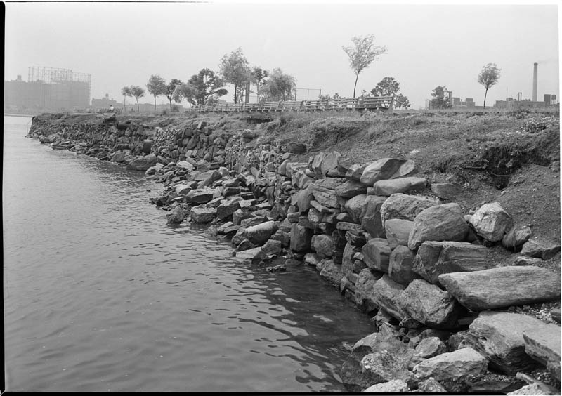
More recently park designers have embraced the geology of the city and region and the rock that serves as the raw material for their designs. At Teardrop Park, a refuge among a dense residential enclave in Battery Park City, landscape architect Michael Van Valkenburgh contrived a cliff of layered stones and a craggy hillside punctuated with boulders that take visual cues from the Hudson River Valley upstate to create what the designer terms a “robust naturalism.” At Brooklyn Bridge Park, Van Valkenburgh has utilized a shoreline rip-rap of stones to establish a sense of wilderness at the water’s edge.
Roots & Rocks
At Rocks & Roots Park in the Morrisania section of the Bronx, whose first phase opens in 2009, landscape architect Nancy Owens takes the natural rock outcropping that dominates the site just off of Third Avenue at 167th Street—what may have been seen as a liability—and turns it into the focus of the park. Owens was inspired in her design for Roots & Rocks Park by the way parkgoers interact with the schist outcroppings in Central Park. In addition to the naturally occurring rock at the site, Owens' plan seeks to reuse the bricks left behind from buildings that existed earlier at the site; the architect researched the names molded in the bricks and determined that they came from brickworks located farther north along the Hudson River Valley.
Still Rocking It
At Printers Park in the Bronx, Parks will adapt 12 large rocks unearthed during excavation of the site in the renovated park. Though Parks Landscape Architect Steve Koren has selected to use the local, naturally occurring mica-encrusted rocks for their aesthetic beauty, this design choice has the added benefit of saving money by foregoing the cost of importing rocks from elsewhere.
Acknowledgments and Further Information
A link with the planet's past, geology is alive and well in New York City and especially New York City's parks. Special thanks for this geology lesson goes to Sidney Horenstein (1936 - 2018), coordinator of Environmental Programs at the American Museum of Natural History, and later the Environmental Educator Emeritus at the institution.
Don't Miss

- Prospect Park for glacial deposits (see in particular Boulder Bridge)
- Ward's Point in Conference House Park on Staten Island for the only exposed part of the terminal moraine
- Although not a city park, Clay Pit Pond State Park for coastal plains deposits
- Forest Park for the topography of the terminal moraine
- For glacial potholes, see Inwood Hill Park in Upper Manhattan and the New York Botanical Garden in the Bronx
- For glacial grooves and striations there are many rock outcrops in Central Park, but see especially Umpire Rock, near 63rd Street and Central Park West.
Read more about the Parks-rocks connection in Parks Monuments and Geology.
%7Cutmcsr%3D(direct)%7Cutmcmd%3D(none)%3B%2B__utmv%3D40601582.-%3B)