Pugsley Creek Park
Pugsley Creek Park
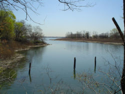
Pugsley Creek, which divides Clason Point (on its west) from Castle Hill Neck (on its east), was originally used by the Siwanoy Indians to reach their village near the tip of Castle Hill Neck. Early documents indicate that the small waterway was called Maeneppis Kill. Castle Hill Neck was settled around 1650 by John Cromwell, a cousin of Lord Protector Oliver Cromwell. Following a disagreement with Oliver Cromwell over the execution of King Charles I, John Cromwell's family moved to the Netherlands and eventually settled in America. Throughout most of the 17th and 18th centuries, Castle Hill Neck became known as Cromwell's Neck, and the nearby creek became Cromwell's Creek.
Cromwell's Creek underwent several name changes in the years following the American Revolution. However, by the mid-1800s, the Pugsley family had acquired a large tract of land known as the Cow Neck Farm, located near what is now Parkchester. With docks located near the present intersection of Lafayette Avenue and White Plains Road, the Pugsley family used the creek for shipping supplies to and from the Cow Neck Farm. Eventually, the creek became known as Pugsley Creek. As New York City's population grew during the late 1800s, the Bronx became increasingly urbanized. Although Pugsley Creek originally extended inland to Westchester Avenue, new development in the area significantly shortened the creek. With the construction of Ludlow Avenue (now Bruckner Boulevard), the northern portion of the creek was filled in. Pugsley Creek was further shortened with the construction of Lacombe Avenue, which marks the current northerly extent of the creek. The acquisition of parkland along Pugsley Creek progressed in several stages throughout the 20th century.
On August 1, 1906, the City of New York condemned a small tract of land on Clason Point, near the mouth of Pugsley Creek, and declared it a Public Place. In 1921, the City transferred a portion of this property to the Department of Marine and Aviation, which operated a ferry between Clason Point and College Point, Queens. The remaining land came under Parks jurisdiction in 1938. The ferry service ended in 1939, and the Department of Marine and Aviation surrendered its parcel to the Board of Estimate in 1956. Although this land was never formally transferred to Parks, it is maintained and operated as Parks property. In 1977 Parks acquired a large parcel along Pugsley Creek north of the original park. On June 18, 1987 the combined parcels were officially named Pugsley Creek Park.
A small team of archaeologists excavated a site near the head of Pugsley Creek and discovered a variety of primitive stone tools, including some which appear to have been crafted as far away as New Jersey. In 1988 Soundview Associates, which was building the Shorehaven housing development adjacent to the park, constructed a ballfield and several facilities for passive recreation at the southern end of park, now known as Clason Point Park. A third property, at the corner of Lacombe and Screvin Avenues, was added to Pugsley Creek Park in 1989. With the support of area residents, Parks developed Gus's Garden (named after a local gardener who supported the project) on a former dumping ground near the corner of Gildersleeve and Betts Avenues in 1996. The fourth parcel of land at Pugsley Creek Park was acquired on February 22, 1999, when Parks obtained jurisdiction over the site of a former sewage treatment plant near the northern end of Pugsley Creek. As a growing park, Pugsley Creek Park has remained largely undeveloped. However, its rich history and scenic location ensure that it will remain a valued public place.
Check out your park's Vital Signs
Clean & Safe
Green & Resilient
Empowered & Engaged Users
Share your feedback or learn more about how this park is part of a
Vital Park System


