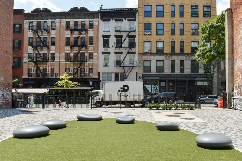
In partnership with the Department of Environmental Protection (DEP), NYC Parks built this plaza situated on DEP property. Working collaboratively with the community, NYC Parks designed a vest pocket plaza enlivened by multi-colored herringbone paving, a central circular gathering spot with “pebble” seating and a synthetic turf green, as well as perimeter plantings. An opening in the western wall connects to the historic Merchant’s House and permits views of its garden.
This site is named in honor of Manuel Gerrit de Reus, Big Manuel, Clyn Manuel, Manuel Sanders, and Manuel Trumpeter. The five Black men were among 28 recipients of land grants in the area earned by people of African descent between 1643 and 1663. Many of them were among the first enslaved Africans brought here by the Dutch West India Company. The mainly farm community is considered by some to be the first Black settlement in what is now New York City. Manuel Gerrit de Reus owned the land this plaza sits on.
Discover the history of Manuel Plaza
Show Disclaimer
Highlights

Check out your park's Vital Signs
Clean & Safe
Green & Resilient
Empowered & Engaged Users
Share your feedback or learn more about how this park is part of a
Vital Park System![]()
 |
%7Cutmcsr%3D(direct)%7Cutmcmd%3D(none)%3B%2B__utmv%3D46330601.-%3B)