Flood Triangle
Flood Triangle
Like all residents of dense urban environments, New Yorkers seize every opportunity to create a patch of green. The Bronx, in particular, is dotted with a number of small, grassy, three-sided plots of land traditionally called squares. Besides creating more of these miniature parks as part of the Greenstreets Program, Parks Commissioner Stern has renamed older parks with the geometrically correct name of triangle. Flood Triangle, named by the Commissioner in 1996, had been Flood Square since 1940. Flood, most likely, was the surname of a local soldier who never returned from World War I. Third Avenue, Washington Avenue, and 188th Street form the boundaries of this park.
This plot in the Fordham section of the Bronx was once part of the Union Hill Farm that belonged to the Reverend William Powell. In 1849, the farm was divided among a group of wealthy landowners that included the Powells, Lorillards, and Bayards. According to the deed, the parties agreed “that we have thought it expedient to appropriate the small parcel marked A [on the map] as a public place or as an open space.” The land came under the jurisdiction of the Parks Department of Westchester County on March 31, 1849, and was adopted as a public park by the City of New York in 1895.
It was the construction of the Third Avenue Elevated Train between 1886 and 1902 that drew flocks of residents to the Fordham area, as well as to the rest of the Bronx. Building the elevated system resulted in thousands of jobs that attracted newly arrived immigrants. For older immigrants the increased accessibility to Manhattan made the Bronx an attractive escape from the crowded tenements of the Lower East Side. Apartment buildings sprang up almost overnight.
From 1902 to 1910 the number of residential structures in the Bronx increased from 882 to 16,192. Not surprisingly many were clustered around the El since nine out of ten New Yorkers lived within half a mile of rapid transit lines. In some areas, passengers on the Third Avenue El could look into the back windows of apartment houses along the route as the train skirted the courtyards of the low-rise buildings. Most of the Els in New York were eventually demolished and replaced with subway lines. The section of the Third Avenue El between Chatham Square and 149th Street closed in 1955; the portion between 149th Street and Gunhill Road lasted until 1973.
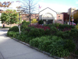
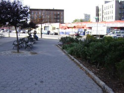
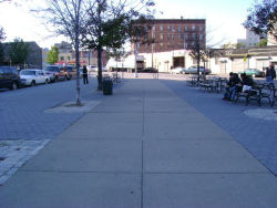
A 1933 photograph of this triangle shows nine concrete benches along the perimeter and two elm trees (Ulmus americana) inside. Although the trees are bare, and the people in the picture are wearing winter clothes, the benches are all occupied. Along the Third Avenue boundary, mothers with baby carriages are sitting in the shadow of the El overhead. Today, though no longer in the shadow of the El, the park remains a pleasant sitting area to be enjoyed by the Fordham community.
Check out your park's Vital Signs
Clean & Safe
Green & Resilient
Empowered & Engaged Users
Share your feedback or learn more about how this park is part of a
Vital Park System


