Paerdegat Basin Park
Paerdegat Basin Park
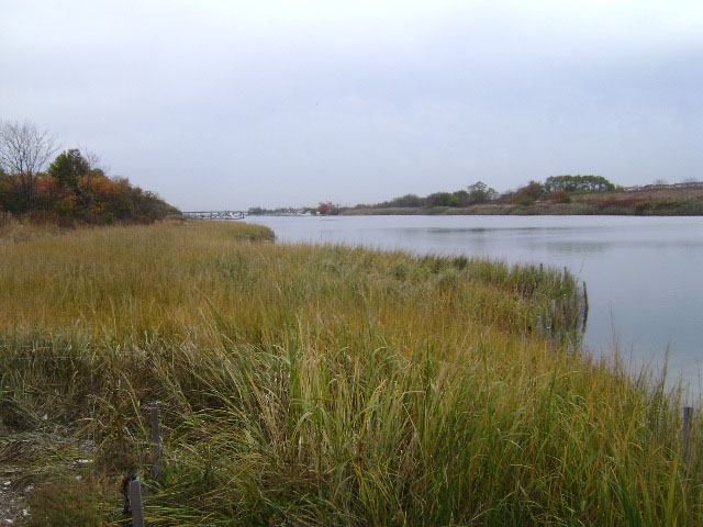
This marshy East Flatbush park comprises a 1.25-mile channel that empties into Jamaica Bay in nearby Bergen Beach. Paerdegat Basin, whose name means “horse gate,” in Dutch is a saltwater wetland area.
Paerdegat Basin is surrounded by two neighborhoods that were developed in the 1960s. Both communities, Georgetown (to the west) and Paerdegat Basin (to the east), are small, designated parts of larger neighborhoods. Georgetown is officially part of Bergen Beach, and Paerdegat Basin of Canarsie.
The area known today as Bergen Beach originally served as a refuge island for the Canarsie Native Americans, whose name still refers to the neighborhood in eastern Brooklyn. The Canarsie called this area Keskachauge or Kestateuw, but the Dutch renamed it New Amersfoort soon after they settled here in the 1630s. When development of the Brooklyn area earnestly began in the mid-1800s, Canarsie served as a hotbed of growth. By the 1950s, the Italian and Jewish neighborhood was one of the most vibrant in Brooklyn.
Paerdegat Basin is a small area of Canarsie that borders the actual basin on the eastern front. It runs along Paerdegat Avenue North and is divided into 15 numbered “Paerdegat streets.” Developers in the 1960s sought to build 400 two-story, colonial-style houses in the Georgetown area and called the community “Georgetowne Greens.” Mayor John V. Lindsay (1921-2000) also pushed for an alternative housing project in the area, however, both plans failed. Eventually, a variety of developers built up the Italian and Jewish neighborhood now referred to as Georgetown.
This park, bounded by Paerdegat Avenue North, Bergen Avenue, Ralph Avenue, and Flatlands Avenue, was acquired by Parks from the Department of Citywide Administrative Services in 1998, and it serves as home to many species of birds and smaller water creatures. The Department of Environmental Protection monitors the park to ensure that it remains a stable environment to support the wildlife in the area. Groves of trees such as the ailanthus (Ailanthus altissima), honeylocust (Gleditsia triacanthos) and Smooth sumac (Rhus glabra) in the basin’s upland region provide a welcome habitat for many species of birds and animals whose numbers have dwindled in recent years.
Although the basin consists of over 160 acres, more than 75 of those are underwater. There are currently no access points to the basin and the best view of the water is available from the Belt Parkway, which spans this vital natural habitat.

Check out your park's Vital Signs
Clean & Safe
Green & Resilient
Empowered & Engaged Users
Share your feedback or learn more about how this park is part of a
Vital Park System![]()

Know Before You Go
Ecology Park is only open at certain times of year when Parks staff are present in order to protect this unique landscape. Want to visit? Check out our Stewardship Projects page for restoration, planting, and educational events.
 |
%7Cutmcsr%3D(direct)%7Cutmcmd%3D(none)%3B%2B__utmv%3D11464018.-%3B)