Greenbelt Hiking Trails
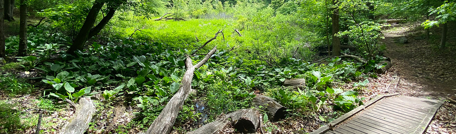
Resting in the heart of Staten Island is the 2,800-acre park system known as the Greenbelt. The Greenbelt includes New York City's largest remaining forest preserve, offering an oasis of peace, quiet, and solitude. It is also home to tidal and freshwater wetlands, oak and beech forests, open meadows, and rolling hills that offer visitors a glimpse into the natural and pastoral heritage of Staten Island. The Greenbelt is an extraordinary natural resource visited by over one million people annually. Most of the Greenbelt is New York City parkland featuring natural areas as well as traditional parks. LaTourette, Willowbrook and High Rock parks feature different environments and activities. Several privately-owned parcels of land, such as William H. Pouch Boy Scout Camp, Richmond County Country Club golf course and Henry Kaufman Campgrounds, are within Greenbelt boundaries. The Greenbelt features over 35-miles of rugged trails as well as a 2.5-mile long perimeter multi-use path. Interior, woodland trails are primarily rated easy to moderate, and serve hikers and runners (cycling is only permitted on the perimeter trail). The trail system traverses diverse ecosystems and offers visitors a refuge from the hustle and bustle of daily life.
Interactive Map
![]() Blue Trail
Blue Trail
![]() William T. Davis Pink Trail
William T. Davis Pink Trail
![]() Paulo's Peak Trail
Paulo's Peak Trail
![]() Red Trail
Red Trail
![]() Yellow Trail
Yellow Trail
![]() Gretta Moulton Trail
Gretta Moulton Trail
![]() Orange Trail
Orange Trail
![]() White Trail
White Trail
![]() Environmental Education Trail
Environmental Education Trail
![]() Nature Center Trail
Nature Center Trail
![]() Multipurpose Trail
Multipurpose Trail
![]() Lavender Trail
Lavender Trail
![]() Red Dot Trail
Red Dot Trail
![]() Heyerdahl Hill Trail
Heyerdahl Hill Trail
![]() Unnamed Official Trails
Unnamed Official Trails
![]() Paw Trail
Paw Trail
![]() Point of Interest
Point of Interest
Trails and Points of Interest
 Blue Trail
 Williams T. Davis
Pink Trail Paulo's Peak Trail
 Red Trail
 Yellow Trail
 Gretta Moulton Trail
 Orange Trail
 White Trail
 Environmental
Education Trail- Nature Center Trail
 Multipurpose Trail
 Lavender Trail
 Red Dot Trail
 Heyerdahl Hill Trail
 Paw Trail
- Unnamed Official Trails
Blue Trail
The Blue Trail is the longest hiking trail in the Greenbelt at over 12 miles, offering easy to moderate difficulty hiking terrain. It takes park users through the heart of the Greenbelt, while crossing through five different Greenbelt parks. The trail connects the more popular Greenbelt parks such as High Rock and LaTourette Parks, to the lesser-known Deere Park where hikers will encounter steeper terrain. A significant section of this trail can be found in LaTourette Park totaling 3.75 miles. Starting on Brielle Avenue where there is street parking and public transportation available, hikers will begin their journey along the back of several neighboring buildings, with ruins from the old and abandoned Seaview Hospital buildings visible from the Greenbelt side of the trail. The trail goes across the heavily forested northern section of the park known as Bloodroot Valley, which parallels Manor Road for some time before crossing Rockland Avenue and entering the Bucks Hollow section of the Greenbelt. Crossing at Richmond Hill Road, you travel through the open fields of LaTourette golf course and into the scenic wetlands of the southern section of LaTourette Park. Here the trail turns back to the north. After crossing over Richmond Hill Road twice, it begins to overlap with the Red Trail south of the LaTourette Golf House. The Blue and Red then meet with the Yellow Trail, passing Buttonbush swamp on the north side of the trail. They all converge next with the White Trail where four trails overlap for a small section. The Blue, Yellow and White Trails turn to the south diverging from the Red Trail and exiting LaTourette Park at Meisner Avenue. Coming out of High Rock Park, the Blue Trail will continue up Richmond Parkway alongside the Pouch Camp New York Department of Environmental Conservation Easement property moving from diverse wetland environments into hilly forests and leading into Deere Park where it comes to an end. There is street parking available at this end of the Blue Trail.
Points of Interest
Forest View at Bloodroot Valley Park: Along the trail connecting the Yellow Trail to the Blue Trail in the northern section of Bloodroot Valley, there is a a good amount of uphill hiking. At this point on the trail, you realize your efforts have paid off and you’re offered a wide-open view of the forested scenery that encompasses Bloodroot Valley.
Valley Overlook at Bloodroot Valley Park: Atop this spectacular ridgeline along the Blue Trail and overlooking the very valley from which this park gets its name, you can enjoy a scenic vista of pristine forests. Down in the ravine lies a beautiful stream and the steepness of the ridge evokes a feeling of exposure that adds to the natural scenery.
View Valley Overlook on the map
View to Lower New York Bay from High Rock Park: Just outside the doors of the Greenbelt administration office in High Rock Park is a spectacular scenic view of Staten Island. On a clear day, the view from this high spot goes all the way to Midland Beach and the Lower New York Bay. The view is best in the fall and winter when leaf coverage is at its lowest.
View to Lower New York Bay
from High Rock Park on the map
Walker Pond at High Rock Park: At the end of the Blue Trail in High Rock Park visitors encounter the iconic and very scenic Walker Pond. There is a reason outdoor educators frequently lead their nature hikes to this location - it is an excellent place to see an abundance of native trees and wildlife including a variety of native fish and birds. As you continue along the trail there are additional views of the pond and surrounding forest.
LaTourette Golf Course rolling hills at Latourette Park and Golf Course: The NYC Greenway that runs through LaTourette Park is mostly flat and has an easy-to-navigate gravel tread. It is perfect for parkgoers of any skill level. Here in the northern section of the Greenway there are spectacular views of the rolling grassy hills belonging to the LaTourette Park Public Golf Course.
View LaTourette Golf Course
rolling hills on the map
Ridgeline Forest View at Latourette Park and Golf Course: A short detour off the Blue Trail in the southern section of LaTourette Park brings you along a scenic ridgeline overlooking the NYC Greenway.
View Ridgeline Forest View on the map
Golf Course view to Atlantic Ocean at Richmond Parkway: A beautiful scenic point with a bench overlooking the rolling hills and greens of the Richmond County Golf Course. Sit and enjoy the view all the way to the Atlantic Ocean.
William T. Davis Pink Trail
The William T. Davis Wildlife Refuge was established in 1928 by renowned local naturalist and a co-founder of the Natural Science Association of Staten Island, William T. Davis. At just under 0.5 miles, today the Pink Trail provides green space for outdoor recreation. Many bird species make their homes in this park’s marshes, including herons (Ardea), egrets (Egretta), ibis (Threskiornithinae), cormorants (Phalacrocorax), and gulls (Larus). On the ground and in the water, snapping turtles (Chelydra serpentina), fiddler crabs (Uca), and muskrats (Ondatra zibethica) can be seen throughout the site. Ample street parking is available and public transportation is accessible to Travis Avenue.
Paulo's Peak Trail
Paulo's Peak, a 200-foot "mountain" offering a 360-degree panorama of Staten Island, was formed when boulders and serpentine rock were removed to construct a highway that was designed during Robert Moses's tenure in the 1960s. Previously known by local residents as "Moses Mountain," it was renamed for former Staten Island Borough Parks Commissioner Thomas A. Paulo in 2022. Today a section of the Yellow Trail (0.25 miles) ascends Paulo's Peak as a scenic nexus to access multiple parks within the Greenbelt including Bloodroot Valley Park, High Rock Park, and LaTourette Park. Street parking is available at Meisner Avenue and public transportation is accessible to this portion of the Yellow Trail.
Points of Interest
Paulo's Peak at Richmond Parkway: One of the most iconic features in the Greenbelt is the artificial “mountain” renamed in 2022 as Paulo's Peak (formerly Moses Mountain). What was originally a pile of rubble from the abandoned parkway project historically defeated by environmental activists in the 1960s is now an epic hiking destination. Climb your way to the top to enjoy nearly panoramic views all year round.
Red Trail
The Red Trail is a 3.2-mile loop trail located in the heart of LaTourette Park’s heavily forested trail network. There are a number of trails that can take you to the Red Trail loop including the Nature Center Trail, Yellow Trail, Blue Trail, and White Trail. The loop covers a majority of the northern section of LaTourette Park, making it a perfect trail to see the wide variety of plants and wildlife that call the Staten Island Greenbelt home. A brief detour from this trail takes you to the Heyerdahl Hill Ruins, an incredible glimpse into the past, if you follow the new Peach Trail markers. Buttonbush Swamp is a picturesque feature along the Red Trail loop located near the turn-off for the tail-end of the loop that leads you through the forest, alongside the community of Lighthouse Hill and to the LaTourette Golf House. There is parking available at the end of the Red Trail.
Points of Interest
Heyerdahl Hill Ruins at Latourette Park and Golf Course: A short detour off the Red Trail in LaTourette Park's northern section will lead park-goers to the historic ruins of Thorwald Heyerdahl’s house built in the 1860s on a hilltop. At 241 feet, Heyerdahl Hill is one of the highest points on the eastern coast. The Heyerdahl Family attempted to grow a grape orchard on the acres surrounding the hilltop, which, due to the serpentine rock underneath the soil, was doomed from the beginning. All that stands today is the house's stone foundation but it offers a glimpse into the lives of historic Staten Islanders. Ghost stories featuring Heyerdahl family members are still popular with local storytellers.
Yellow Trail
The Yellow Trail is a long trail that extends eight miles through multiple Greenbelt parks. The Yellow Trail begins at Helena Road near St. Francis Woodlands in the community of Todt Hill. There is a parking lot to start your hike. Spanning nearly the entire distance of Richmond Parkway, the Yellow Trail splits for a quick trip up Paulo’s Peak for a view of the expansive Greenbelt woodlands before it crosses over the intersection of Manor Road and Rockland Ave, which serves as the confluence for four different Greenbelt parks. The Yellow Trail continues into the northern section of LaTourette Park entering at Meisner Avenue. It then works its way west across the forested trail network of the park's northern section and meets up with the NYC Greenway and Greenbelt Multipurpose Trail, running parallel to the LaTourette Public Golf Course. After crossing Richmond Road, the Yellow Trail winds through the scenic wetlands of LaTourette’s southern section until it reaches its terminus off Forest Hill Road. Street parking and public transportation are readily available at this trailhead.
Points of Interest
Forest View at Bloodroot Valley Park: Along the trail connecting the Yellow Trail to the Blue Trail in the northern section of Bloodroot Valley, there is a good amount of uphill hiking. At this point on the trail, you realize your efforts have paid off and you’re offered a wide-open view of the forested scenery that encompasses Bloodroot Valley.
LaTourette Golf Course rolling hills at Latourette Park and Golf Course: The NYC Greenway that runs through LaTourette Park is mostly flat and has an easy-to-navigate gravel tread. It is perfect for parkgoers of any skill level. Here in the northern section of the Greenway there are spectacular views of the rolling grassy hills belonging to the LaTourette Park Public Golf Course.
Gretta Moulton Trail
Located in High Rock Park, this circular trail is named after Greenbelt activist Gretta Moulton, who effectively mobilized the community to protect High Rock Park from development in the 1960s. Parts of this trail will take you out of High Rock Park and into Richmond Parkway. From here you can loop back to your start point in High Rock or embark on the Blue or Yellow trails through Richmond Parkway into Deere Park. The total length of the Gretta Moulton trail is 0.6 miles, and it loops around a hilly section of the park with a picturesque stream running through the center of it, with easy to moderate hiking. Parking is available at the Nevada Avenue parking lot, and public transportation brings you to the base of Nevada Avenue.
Orange Trail
This is a short but hilly, easy to moderate, hiking trail through the charming wetlands of Reed’s Basket Willow Swamp Park. Jerome X. Wetland Pond is an excellent site for bird watching with possible sightings of the Great Blue Heron. The trail winds around the pond where egrets and belted kingfishers can be seen on your way to the ruins of what is believed to be the Reed family home, which was burned down by John Reed after he sold the property in the late 19th century. The length of this trail is 0.8 miles, with many historical ruins to be uncovered along your journey. Parking is available at the Chapin Avenue trailhead, and public transportation is a short walk from nearby Richmond Road.
Points of Interest
Wetland Pond at Reed's Basket Willow Swamp Park: Reeds Basket is one of the least known of the Greenbelt parks. Tucked away in a suburban Staten Island neighborhood, this park is frequented by locals and for good reason, it is home to one of the most scenic natural bodies of water in all of New York City. Escape the fast-paced city life and enjoy some time in undisturbed nature.
Creek View to Wetland Pond at Reed's Basket Willow Swamp Park: A scenic view from a small bridge down the creek with a view to Wetland Pond. With fewer visitors, this park is bustling with wildlife and the pond is a perfect place to sight native birds such as Great Blue Herons.
White Trail
The White Trail spans nearly six miles across three Greenbelt parks, with mostly easy, but sometimes moderate hiking. Starting in Willowbrook Park and then crossing Rockland Ave into LaTourette Park, 1.5 miles of this trail go through the northern section of LaTourette Park. The White Trail moves out of LaTourette and into Willowbrook Parkway where it continues to the Gateway National Recreation Area, by winding through the scenic forests and extensive trail network of Bucks Hollow, passing through Egbertville Ravine, and following the section of the trail known as the Amundsen Trail to its terminus at Hylan Boulevard. Along your hike, you’ll pass along many streams, ponds, swamps, and even the Richmond Creek, with plenty of opportunities for observation of aquatic species of flora and fauna. Parking is widely available at both ends of the White Trail, and it is easily accessible by public transportation. Restrooms are available in Willowbrook Park.
Points of Interest
Historic Stone Chimney at Willowbrook Park: Along the White Trail, as it winds through the forests of Willowbrook Park, lies the remains of an unknown historic building. A lone chimney stands among the trees, all that remains of a building that once stood along the creek that runs through the park. Some speculate this structure was once used by George Washington during the American Revolution.
View Historic Stone Chimney on the map
Willowbrook Pond at Willowbrook Park: One of the most scenic bodies of water in Staten Island, Willowbrook Pond is a haven for local wildlife and is surrounded by a paved and accessible trail so that park-goers of all ability levels are able to enjoy the pond's natural beauty. The pond is lined with several weeping willow trees and is one of the best locations in the Greenbelt to observe these spectacular trees. Fishing is permitted in Willowbrook Pond making this a very popular destination for park-goers with the required fishing license. Note that NYS DEC requires Catch and Release for Freshwater Fishing.
View Willowbrook Pond on the map
Scenic Wetland & Birdwatching at Willowbrook Parkway: In this thin strip of parkland in between two residential Staten Island neighborhoods lies this scenic wetland. It is home to an abundance of native wildlife. The bustling wetland ecosystem is the perfect place to see a variety of native birds.
View Scenic Wetland & Birdwatching
at Willowbrook Parkway on the map
Stream Crossing at Willowbrook Parkway: Willowbrook Parkway is a unique park - a scenic natural area nestled in between two busy Staten Island roads. This scenic view at the beginning of the White Trail is an oasis of natural beauty in the middle of the hustle and bustle of suburban Staten Island. It features a beautiful stream with a bridge crossing.
Environmental Education Trail
This loop trail located just off of the Nature Center Trail is very short at only .06 miles but packs in some of the best forest scenery that LaTourette Park has to offer. On top of its scenery, the trail is incredibly educational because of the excellent examples of native trees and plants. Located in close proximity to the Nature center, it is a great destination for park goers seeking a shorter and more accessible experience, and it is often used as a closer nature trail to visit for Early Education programs.
Nature Center Trail
The one-mile-long Nature Center Trail begins at “Mitchell Crossing,” the wooden footbridge on the eastern edge of the Nature Center grounds, and maintains a mostly easy hike all the way through. The semi-circular trail leads to a native fern garden stretching out under a canopy of tall tulip, beech, and birch trees. The first straight-away of the trail has been renovated to install durable surfaces that are easier to navigate by wheelchair, walker, or stroller- making this nature trail more accessible to a wider range of park-goers. In spring, Canada mayflower, trout lilies and wild violets proliferate. Public transportation is readily available, as is ample parking in the Greenbelt Nature Center lot. Restrooms are available at the Greenbelt Nature Center.
Points of Interest
Scenic Wetland & Birdwatching at LaTourette Park & Golf Course: Shortly after embarking on the Nature Center Trail, park goers will encounter this scenic swamp among the dense forests of LaTourette park's northern section. Native trees tower above the swampy terrain making this an incredible spot for birdwatching.
View Scenic Wetland & Birdwatching at
LaTourette Park & Golf Course on the map
Multipurpose Trail
The Multipurpose Trail differs greatly from the Greenbelt’s woodland trails. This new, pedestrian-friendly trail is also the only trail on which bike riding is permitted. The mostly flat 2.6-mile circuit has a crushed gravel surface and six-foot wide walkways. It extends westward from Rockland Avenue along Forest Hill Road, hugging the perimeter of LaTourette golf course toward Richmond Avenue. The view over the golf course with the forest of the Greenbelt in the distance is unlike anything else you’ll find. There is a split in the trail which gives park-goers the option to travel towards Historic Richmond Town, or continue straight to Field of Dreams. For a time, the Blue and Yellow Trails both travel the same path as the Multipurpose Trail, giving hikers more options to continue their nature exploration. There is street parking and lot parking available, as well as ample public transportation along Forest Hill Road.
Points of Interest
LaTourette Golf Course rolling hills at Latourette Park and Golf Course: The NYC Greenway that runs through LaTourette Park is mostly flat and has an easy-to-navigate gravel tread. It is perfect for parkgoers of any skill level. Here in the northern section of the Greenway there are spectacular views of the rolling grassy hills belonging to the LaTourette Park Public Golf Course.
View LaTourette Golf Course
rolling hills on the map
Stream Crossing at LaTourette Park & Golf Course: This stream crossing at the southern Terminus of the NYC Greenway trail affords a view with a mix of forest and wetland scenery. The Greenway is mostly flat and has an easy-to-navigate gravel tread that is perfect for parkgoers of any skill level.
View Stream Crossing at LaTourette Park
& Golf Course on the map
Lavender Trail
A short but extremely scenic loop, the Lavender Trail in High Rock Park traverses through one of the most biologically diverse sections of the Greenbelt. The Lavender Trail easily connects to many other trails within the park, bringing visitors around the scenic Loosestrife Swamp. Jewelweed, skunk cabbage, and various grasses, ferns, and water plants can be found, along with black water snakes, snapping turtles, and spring peepers. The total length of this trail, which is perfect for environmental education trips and family hikes is 0.3 miles, with other short High Rock trails nearby to continue your nature exploration. Parking is available at the Nevada Avenue parking lot, and restrooms are available in the park.
Red Dot Trail
This short loop trail is located in the heart of High Rock Park moving through forested woodlands with scenic ponds throughout. At times, this steep terrain can make for moderate hiking, and perfect for exercising. This is a great trail to observe native plants and trees and is also a great location to potentially see wildlife such as deer, Great Blue Herons, Painted Turtles, and more! The length of this trail is 0.5 miles. Parking is available in the High Rock parking lot and restrooms are available.
Heyerdahl Trail
Points of Interest
Heyerdahl Hill Ruins at Latourette Park and Golf Course: A short detour off the Red Trail in LaTourette Park's northern section will lead park-goers to the historic ruins of Thorwald Heyerdahl’s house built in the 1860s on a hilltop. At 241 feet, Heyerdahl Hill is one of the highest points on the eastern coast. The Heyerdahl Family attempted to grow a grape orchard on the acres surrounding the hilltop, which, due to the serpentine rock underneath the soil, was doomed from the beginning. All that stands today is the house's stone foundation but it offers a glimpse into the lives of historic Staten Islanders. Ghost stories featuring Heyerdahl family members are still popular with local storytellers.
Paw Trail
The Paw Trail is a beautiful, secluded ½-mile long path which extends from the Gypsy Hollow Building at the Red Dot Trail, one of the highest areas of the park, to the park entrance on Summit Avenue. As it passes the Greenbelt administrative and environmental education buildings, the trail is paved path, but it leaves pavement behind as it overlaps with the Blue Trail and begins its descent. The grade is mostly gentle, with a few short steep sections. During the descent, a careful observer can catch a glimpse of Lower New York Bay. The Paw Trail diverges from the Blue Trail where it curves around the shore of Walker Pond before reaching its terminus at Summit Avenue.
Unnamed Official Trails
Points of Interest
Scenic Forest View at Deere Park: Deere Park is one of the least visited of the Greenbelt parks, which makes it one of the best places to go to see wildlife. In this section of the park, enjoy some of the more difficult hiking terrain that the Greenbelt has to offer. The significant topography offers incredible views. This scenic point on the ridge allows you to take in a significant portion of the park; if you’re quiet enough you’ll certainly run into some Staten Island deer.
View Scenic Foreset View on the map
Ridgeline View at High Rock Park: High Rock Park is known for its variety of different landscapes and this ridgeline trail seems to have it all. Overlooking the Lavender Trails’ wetlands on one side and the scenic forests of the Greta Moulton Trail on the other, this ridgeline trail boasts spectacular scenery offering a near panoramic view of the best High Rock Park has to offer.
View Ridgeline View on the map
Historic Stone Structure at Latourette Park and Golf Course: Near the Greenbelt “Field of Dreams” at the southern end of LaTourette Park rests a historic structure. A stone ruins of a structure built around the natural stream that may have been used to harness the water source for a variety of purposes.
View Historic Stone Structure on the map
Ridgeline Forest View at Latourette Park and Golf Course: A short detour off the Blue Trail in the southern section of LaTourette Park brings you along a scenic ridgeline overlooking the NYC Greenway.
View Ridgeline Forest View on the map
Brookfield Park Wetlands View at Latourette Park and Golf Course: This section of LaTourette Park runs alongside the Brookfield Park wetlands giving park goers an excellent opportunity to view the natural beauty of the wetland without damaging the fragile ecosystem by passing through it. This location offers a view that extends across the wetland.
View Brookfield Park Wetlands View on the map
Forest View at Bloodroot Valley Park: Along the trail connecting the Yellow Trail to the Blue Trail in the northern section of Bloodroot Valley, there is a good amount of uphill hiking. At this point on the trail, you realize your efforts have paid off and you’re offered a wide-open view of the forested scenery that encompasses Bloodroot Valley.
Ohrbach Lake at Richmond Parkway: Here on the Border of Richmond Parkway and the Boy Scouts of America (BSA) owned Pouch Camp lies one of the most significant bodies of fresh water on Staten Island, Ohrbach Lake. Enjoy the spectacular scenery and you'll almost forget you're in New York City.
Walker Pond at High Rock Park: At the end of the Blue Trail in High Rock Park visitors encounter the iconic and very scenic Walker Pond. There is a reason outdoor educators frequently lead their nature hikes to this location - it is an excellent place to see an abundance of native trees and wildlife including a variety of native fish and birds. As you continue along the trail there are additional views of the pond and surrounding forest.
Trail Guides
- Download the Blood Root Valley Trail Guide
- Download the Deere Park Trail Guide
- Download the High Rock Park Trail Guide
- Download the High Rock Park & Richmond Parkway Trail Guide
- Download the LaTourette North Trail Guide
- Download the LaTourette South Trail Guide
- Download the Paulo's Peak Trail Guide
- Download the Reeds Basket Trail Guide
- Download the Richmond Parkway Trail Guide
- Download the William T. Davis Trail Guide
- Download the Willowbrook Park Trail Guide
- Download the Willowbrook Parkway Trail Guide
Hiking in NYC Parks
Visit our Hiking in NYC Parks page to find more nature trails in parks across New York City.
%7Cutmcsr%3D(direct)%7Cutmcmd%3D(none)%3B%2B__utmv%3D55010218.-%3B)