Cunningham Park Hiking Trails
Cunningham Park is a prime example of the vibrant force of nature within an urban setting. Despite the proximity of three major highways (the Long Island Expressway, the Grand Central Parkway and the Clearview Expressway), more than two-thirds of the park remain undeveloped natural land filled with greenery and wildlife. Within yards of speeding cars, mallard ducks settle down for the night on centuries-old glacial kettle ponds and ancient oaks.
Orange Trail: The 1.3-mile Orange Trail loop leads through native hardwood (oak-hickory) forest, which features a diverse ecosystem and along the park's kettle ponds (or seasonal vernal pools) that feature the sounds of spring peepers and other species of frogs throughout the spring and summer season. The rolling terrain of Cunningham Park was carved out by glaciers nearly 20,000 years ago and leaving a terminal moraine at the southern end of the Southeast Preserve on the Orange Trail.
White Trail: The 1.1-mile White Trail connects the Southwest section of Cunningham Park with the Southeast preserve. The White Trail is also accessible from the corner of Union Turnpike and Francis Lewis Boulevard. This trail overlaps for a short time with the Orange Loop and also leads to several kettle ponds within the Southeast Preserve.
Interactive Map
![]() Orange Trail
Orange Trail
![]() White Trail
White Trail
![]() Unmarked Trail
Unmarked Trail
![]() Point of Interest
Point of Interest
Download the Cunningham Park Trail Guide.
Points of Interest
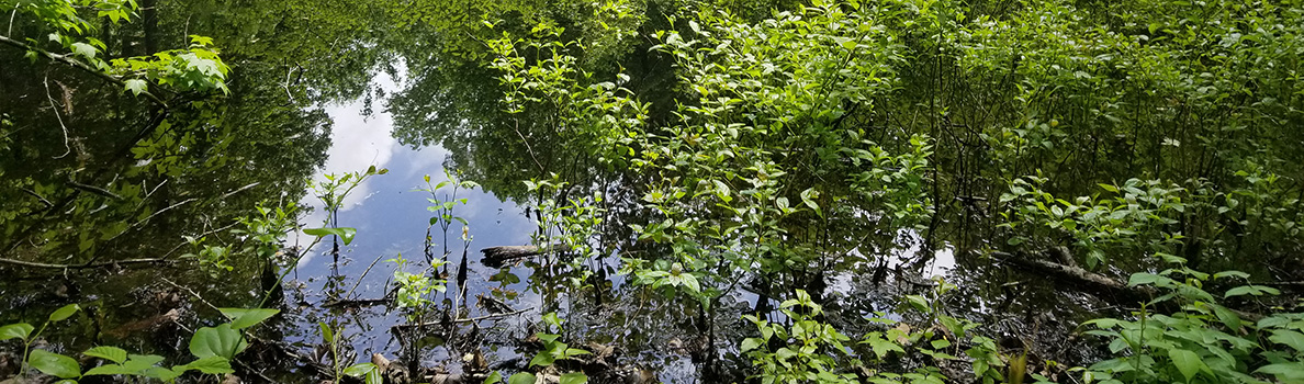
Vernal Pools
A vernal pool is a small, shallow temporary body of water also called a kettle pond or pool when formed by retreating glaciers. Vernal pools are usually filled with snow melt and spring rain, and holds water for two to three months during the spring and summer. Most vernal pools are found in upland forests. Vernal pools support many different species that depend on the water for reproductions such fairy shrimp, wood frog, and several species of mole salamander, although they dry out each year so that permanent fish populations cannot be established. Other species that can be found in vernal pools are amphibians such as newts, spring peepers, frogs, toads and turtles, as well as invertebrates such as freshwater finger clams, snails and leeches. Plant communities include submergent (mostly under water), floating plants, and emergent (vascular plants along the water’s edge).
A Green Oasis – Forests & Migrating Birds
New York City’s forests are incredibly diverse and made up of four different layers: the canopy layer, the shrub layer, the understory plant layer and the ground layer of plants. Each layer is home to a distinct set of plants and animals. This forest and its ponds are an important resource for migrating birds. Look for gray-checked thrushes or worm eating and hooded warblers. Check the ponds for green-backed herons and the surrounding woods for red-bellied woodpeckers and red-eyed vireos. Sometimes, you can see red-tailed hawks looking for a meal.
View Forests & Migrating Birds on the map
A Green Oasis – Vernal Ponds & Amphibians
Vernal ponds are seasonal wet areas. They are home to a variety of amphibians, but may dry up during the summer. Frogs, toads and salamanders have ample time to rear their young during the springtime then leave the water to live in the damp forest. Most of the plants here are adapted to wet conditions. Beneath the surface of this trailside pond is a world teeming with life. Tadpoles, insect larvae, turtles, salamanders, and a myriad of microscopic creatures are just a few of the beings that call a pond their home.
View Vernal Ponds & Amphibians on the map
Wisconsin Ice Sheet Terminal Moraine
About 22,000 years ago, glaciers extended south forming a great ice sheet that covered much of the Northern Hemisphere. This sheet was a mile thick in places and extended south into North America. The Wisconsin ice sheet stopped at this location. As the mountain of ice began to recede northward it dropped boulders and sediment as it melted. This moraine is higher than the rest of the area due to deposits that occurred. The chunks of ice that fell from the glacier created the valley, hills and ponds as the ground is pushed by the sheet weight of the ice.
%7Cutmcsr%3D(direct)%7Cutmcmd%3D(none)%3B%2B__utmv%3D15339015.-%3B)