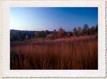
Staten Island Greenbelt Preserve
Staten Island Greenbelt Preserve
Borough: Staten Island
Acres: 1352
Habitat Type: Forest, Grassland, Freshwater Wetland, Salt Marsh
The Staten Island Greenbelt is a monument of natural resource preservation in a rapidly developing environment. With the exception of High Rock Park, the woodlands of the Greenbelt are relatively young but support a great diversity of plants and wildlife. Along the Greenbelt Trail are many small wetlands that provide critical habitat for amphibians. The forests in the Greenbelt range from red maple-sweetgum swamp forests to upland oak woods. Variations in topography, geology, and native soil types support a great diversity of plants including NYS listed rare plants and many native plants that cannot be propagated due to their complex association with soil fungi. The only way to preserve native orchids, ground pines, and other plants with these special requirements is to preserve their habitat.
Directions
The Greenbelt Nature Center and High Rock Park are two ideal places to begin a tour of the Staten Island Greenbelt Preserve.
Greenbelt Nature Center
Public Transit: From the Staten Island Ferry terminal, take the S57 bus to the Brielle and Rockland Ave stop and then cross the street at the light to get to the center.
By Car:From the Verazzano-Narrows Bridge, take 278 West to the Bradley Ave exit. From the service road, turn left onto Bradley Ave. Continue until the intersection of Bradley and Brielle Ave. Turn right and go to the end of the road which leads right to the Nature Center parking lot.
From the Outerbridge crossing, take the Richmond Parkway to the Richmond Ave North exit. Turn left onto Richmond Ave and pass the mall. Then turn right onto Rockland and proceed about 2 miles to the intersection of Richmond and Brielle Ave. The parking lot for the nature center is on the right.
High Rock Park
Public Transit:The S57 runs from the Port Richmond Terminal along Rockland Ave. Get off at the intersection of Rockland Avenue and Nevada and walk north toward the conservation center. The S54 also runs along Rockland Ave from Livingston to Hylan Boulevard.
By Car:From the Verrazano-Narrows Bridge, take 278 to the Todt Hill Road/Slosson Ave exit. Make a left turn onto Slosson Ave and go up the hill (Todt Hill Road) to Ocean Terrace. Make a right onto Ocean Terrace and follow it to Manor Road. Make a left onto Manor Road and then a left onto Rockland Ave and left onto Nevada Ave. The parking lot for the nature center is at the end of Nevada Ave.
Local directions: Take Richmond Road to Rockland Avenue. Take Rockland Avenue to Nevada Avenue (right turn) and follow it to the parking lot. Or take Richmond Avenue to Rockland Avenue. Take Rockland Avenue to Nevada Avenue (about 2 miles). Make a left turn on Nevada Avenue and follow it to the parking lot.
