Zion Triangle
Pitkin Ave., E. New York Ave. bet. Crafton St. and Legon St.
Brooklyn
Directions via Google Maps
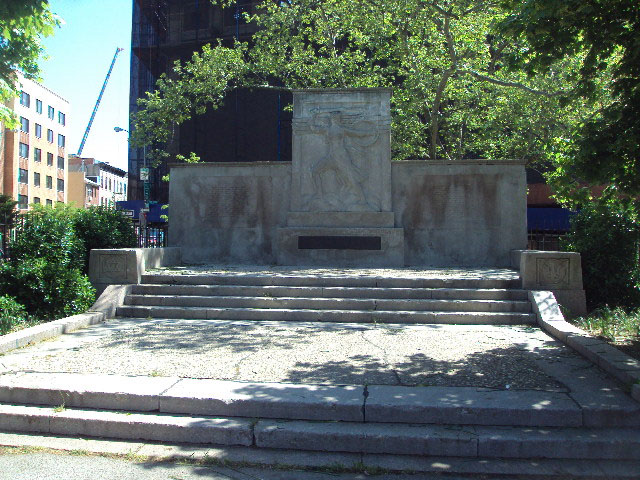
In 1896, the City of Brooklyn acquired this triangular property, bounded by Legion Street, Pitkin, and East New York Avenue at the junction of Eastern Parkway. The new park, or “gore” (small, triangular parcel) as it was called then, was donated by landowner Peter L. Vandeveer, and known in its early years as Vandeveer Park. The 1896 Brooklyn Parks Annual Report noted a small shelter at the site and noted that the park “will be exceedingly useful as a resting place for bicycle riders who use the Glenmore Avenue route to the good roads of Queens County.” In 1911, the park was renamed Zion Park by the Board of Aldermen. Zion is derived from an Old Testament reference to the City of David.
Show Disclaimer
Highlights

Check out your park's Vital Signs
Clean & Safe
Green & Resilient
Empowered & Engaged Users
Share your feedback or learn more about how this park is part of a
Vital Park System![]()
 |
%7Cutmcsr%3D(direct)%7Cutmcmd%3D(none)%3B%2B__utmv%3D70328342.-%3B)