What was here before?
Once known as Bedford Corners and Stuyvesant Heights, Bedford-Stuyvesant came together to form one of the largest African American neighborhood in New York City. Located in north central Brooklyn, the neighborhood was Dutch farmland in the 17th and 18th centuries. In the early 19th century, the farmland was divided into housing lots and sold to formerly enslaved and free Black people who settled in the area.
How did this site become a playground?
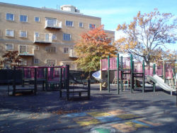
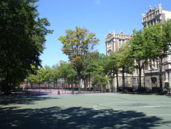
In 1929, Parks purchased this site for use as a playground. The area was once a busy residential and factory district in dire need of a recreational facility. In 1934, Taaffe Playground officially opened. Its features included basketball courts, a soccer field, a handball court, swings, slides, and other play equipment.
Show Disclaimer
Highlights
Check out your park's Vital Signs
Clean & Safe
Green & Resilient
Empowered & Engaged Users
Share your feedback or learn more about how this park is part of a
Vital Park System


