Spring Creek Park
Spring Creek Park
What was here before?
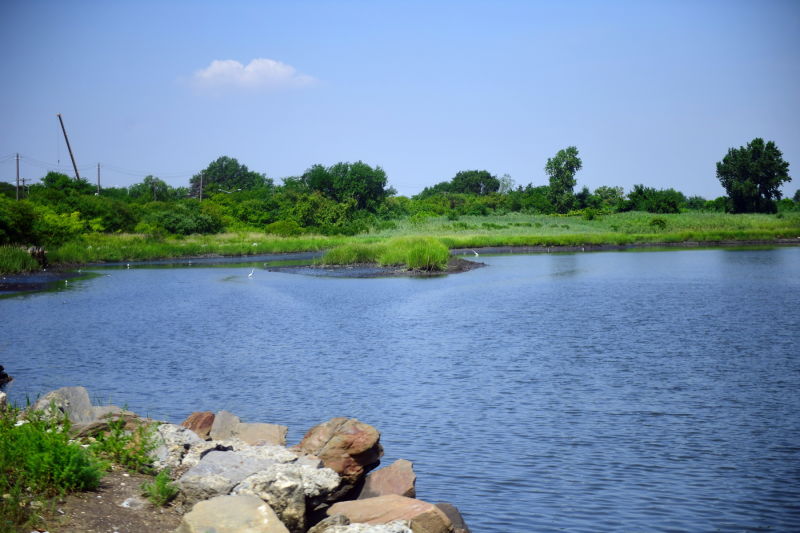
Spring Creek Park contains the largest tract of undeveloped land and wetlands in the northern Jamaica Bay area. The name “Jamaica” comes from the area’s first inhabitants, the Jameco, or Yamecah Native Americans, who lived on the northern shore of Jamaica Bay and along Beaver Stream and Beaver Pond (filled in in 1906). A shallow tidal wetland approximately 20 square miles between Brooklyn and Queens, Jamaica Bay consists of grassy marshes sheltered from the Atlantic Ocean by the Rockaway Peninsula. It contains many islands, though only the largest, Broad Channel, is inhabited. The northern half of the island contains the Jamaica Bay Wildlife Refuge.
The bay was a fishing and hunting ground for the Native Americans before they were displaced by Dutch settlers. The area remained largely unsettled until 1880, when the New York, Woodhaven, and Rockaway Railroad built a wooden trestle five miles long across the bay, connecting the Rockaways to the rest of Queens. As industry expanded along its shores, waste and sewage polluted the bay. In 1916, the board of health banned fishing and swimming here, and the summer resort hotels along the bay closed. Both the bay’s waters and shores have been the focus of cleaning and conservation efforts. Today, a part of the bay and its surrounding area is protected as part of the Gateway National Recreation Area, created in 1972 under the National Park Service.
How did this site become a park?
The original land for Spring Creek Park was acquired by condemnation in May 1938 for the construction of the Shore Parkway section of the Belt Parkway, which runs through the park. Proposed by Robert Moses in 1930 to provide limited-access highway from Manhattan to Long Island, the 36-mile long Belt Parkway was completed in 1941. Much of the Belt Parkway runs through parkland, particularly on the eastern shore. The Shore Parkway section begins at the Gowanus Expressway in Bay Ridge and ends at Cross Bay Boulevard in Howard Beach.
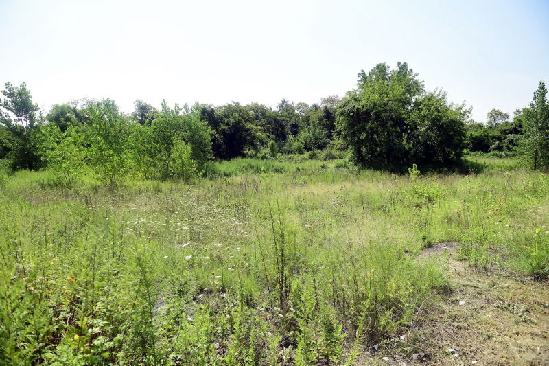
In 1992, the Department of Real Property assigned another section of property to NYC Parks, more than doubling the size of the park. The northern and farthest western portion of the park lies in Brooklyn, while the southern portion below 157th Avenue is in Queens. In 1994 and 1995, two more parcels in Queens, on Fairfield Avenue, were added to the park. In keeping with the wilderness of the surrounding area, the park has been left mostly undeveloped. Almost entirely marshland, the park serves as open greenery for various species of birds including great blue herons, egrets, red-winged blackbirds, pheasants, and mallards, as well as animals such as deer, raccoons, and muskrats.
What is this park named for?
This park is named for a creek that once flowed from present-day Highland Park and Forest and emptied into the Jamaica Bay. Though much of it has been built upon or filled in, reducing its length to less than a mile, sections of Spring Creek are still visible above ground on the border of East New York and Lindenwood.

Check out your park's Vital Signs
Clean & Safe
Green & Resilient
Empowered & Engaged Users
Share your feedback or learn more about how this park is part of a
Vital Park System![]()
 |
%7Cutmcsr%3D(direct)%7Cutmcmd%3D(none)%3B%2B__utmv%3D38228822.-%3B)