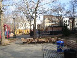
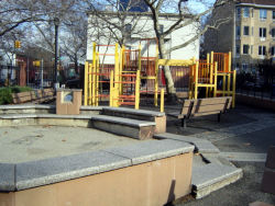
Located on 6th Avenue between 18th and 19th Streets, Slope Park takes its name both from the community that surrounds it, Park Slope, and for the slight southwesterly slope of the park’s topography. The neighborhood of Park Slope derives its name from its proximity to Prospect Park and the gradual topographical incline from the Gowanus Canal to the park. First inhabited by the Canarsee Indians, the neighborhood now known as Park Slope was colonized by Dutch farmers in the 1660s. During the Revolutionary War (1775-1783), the area became the site of a brief, explosive moment, in what is known as the Battle of Brooklyn, or the Battle of Long Island. On August 27, 1776, an outnumbered American regiment faced approximately 4,000 British soldiers at Battle Pass, a point now contained within Prospect Park.
Show Disclaimer
Facilities
Highlights
Check out your park's Vital Signs
Clean & Safe
Green & Resilient
Empowered & Engaged Users
Share your feedback or learn more about how this park is part of a
Vital Park System


