What was here before?
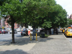
This sliver of Manhattan marks the spot where the tangled jumble of lower Manhattan meets the regularity of the Commissioners’ Plan street grid. With the implementation of the Manhattan grid plan proposed in 1811, a new order of north-south avenues and east-west streets was imposed upon New York City.
First Avenue opened to traffic in 1813, and by the end of the year, stretched from North Street (now Houston Street) to 25th Street. The new grid system did not align exactly with North Street, and with the opening of First Street in 1824, this small triangle was formed. Residential buildings lined the triangle for a century before being demolished.
Show Disclaimer
Check out your park's Vital Signs
Clean & Safe
Green & Resilient
Empowered & Engaged Users
Share your feedback or learn more about how this park is part of a
Vital Park System


