Mount Prospect Park
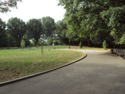
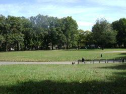
Mt. Prospect Park
Mount Prospect, the second highest point in Brooklyn, draws its name from the sweeping vistas it affords viewers. It was used by the Continental Army in 1776 as a lookout point, which at that time offered strategic views of Manhattan, Brooklyn, New York harbor, a portion of New Jersey, Staten Island, and Long Island. In 1856, the City of Brooklyn built a reservoir at the peak of this hill to supply water to its western section.
In 1860, the City of Brooklyn designated Mount Prospect as part of a colossal new Brooklyn park, Prospect Park. It was seen as advantageous to keep the reservoir surrounded by parkland to protect the purity of the water supply, and the breathtaking views warranted its inclusion in the designs for the coming park. Several years later however, the park’s designers, Frederick Law Olmsted (1822–1903) and Calvert Vaux (1824–1895) felt that Flatbush Avenue’s bisection of the planned park was an unwelcome piece of the landscape. They redrew the park’s borders to include only the uninterrupted area of available lands west of Flatbush Avenue—today’s Prospect Park, excluding Mount Prospect.
Though not included in Prospect Park, whose name it inspired, the land remained under the Brooklyn’s municipal control, until the City of Brooklyn dissolved into another city’s boundaries. On January 1, 1898, the cities and towns of the five boroughs area became consolidated into New York City. The consolidation effort, led by public official Andrew Haswell Green (1820–1903), was intended to improve shipping, railroads, and utilities by centralizing municipal government, and it instantly made New York the largest, most populous city in the United States. Through consolidation, Mount Prospect and its reservoir came under the control of the City of New York’s Department of Water Supply, Gas, and Electricity.
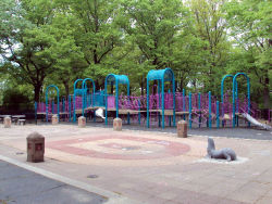
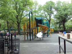
Because of the continued development of New York City water sources and delivery systems, especially the expansion of water sources drawn from the Catskill Mountains and the Delaware River Valley, the Mount Prospect water reservoir was obsolete by the end of the 1930s. In 1940, the City transferred control of Mount Prospect to Parks, which then developed the land into a playground, simultaneously built with the adjacent Brooklyn Public Library, completed the following year.
Mt. Prospect Park is located on Eastern Parkway near Underhill Avenue, just off of Grand Army Plaza. In 1996, a $552,000 renovation of the playground, funded through the efforts of City Council Member Mary Pinkett included play equipment, swings, game tables, benches, a spray shower, a drinking fountain, a new drainage system, and new trees. In 1998, Mayor Giuliani allocated $111,615 in funding for play equipment upgrading, safety surfacing, and handball courts. In 2001, Council Member Pinkett provided an additional $450,000 for renovation of the public restroom, and Mayor Giuliani provided $3,045,000 for reconstruction of the playground.
Although Mount Prospect no longer offers views as far as New Jersey and Long Island, this park, nestled between Brooklyn’s largest cultural and recreational institutions, namely the Brooklyn Museum, the Brooklyn Public Library, Brooklyn Botanic Gardens, and Prospect Park, offers recreational opportunities among and above its surroundings.
Check out your park's Vital Signs
Clean & Safe
Green & Resilient
Empowered & Engaged Users
Share your feedback or learn more about how this park is part of a
Vital Park System


