Mosholu Parkway
Moshulu Parkway
Mosholu Parkway is a landscaped highway connecting Bronx Park to Van Cortlandt Park. “Mosholu” is an Algonquin name meaning “smooth stones” or “small stones” for the nearby creek now known as Tibbett’s Brook. The southern end of the parkway was once home to another creek that ran under what is now Middlebrook Road, and it supplied water to a British fort located on old Van Cortlandt Avenue East during the Revolutionary War.
The plan for New York’s City’s original parkway system was conceived during the 1860s by distinguished landscape architect Frederick Law Olmsted (1822-1903). He conceived a system of parks connected by a new type of road called a “parkway.” The parkways’ scenic qualities made them extensions of the parks they were connecting. To accommodate an increasing number of drivers, parkway traffic was divided according to purpose. The center roadway was reserved for private through traffic, and local and commercial vehicles were routed along parallel side roads. Landscaped greenery was used to separate the outer and inner roadways. A further deterrent to congestion was the elimination of intersections: all intersections were either bridged over or tunneled under the parkway. Among the existing parkways actually designed by Olmsted, Eastern Parkway, and Ocean Parkway still fulfill their intended function.
The creation of Mosholu Parkway came as a result of the widespread park and parkway movement that Olmsted pioneered. In 1881, John Mullaly (1835-1915), a former newspaper reporter and editor, and a group of citizens concerned with widespread urban growth formed the New York Park Association. The group’s lobbying efforts helped the passage of the New Parks Act in 1884, which funded the acquisition of several major undeveloped lands with the purpose of creating parks and parkways. By 1888, the City had acquired properties in the Bronx that would eventually become known as the Van Cortlandt, Pelham Bay, Bronx, Crotona, and Claremont Parks, as well as four parkways, including the Mosholu Parkway.
Along the parkway at Marion Avenue, a World War I monument by Jerome Conner depicts a group of American doughboys in action. Frisch Field is located at Mosholu Parkway and Webster Avenue by Botanical Square. In 1948, the baseball field was named in honor of Frank “Fordham Flash” Frisch (1898-1973), a major league baseball player and manager, Fordham alumnus, and Bronx resident.
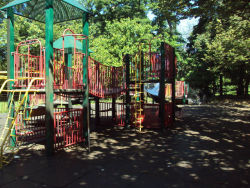
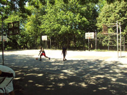
Public restrooms are available at Jerome and Webster Avenues. Mosholu Playground at Parkway North and Kossuth Avenue offers basketball, shuffleboard, and volleyball courts in addition to children’s play equipment.
The south end of the parkway borders the New York Botanical Garden, an internationally-renowned public garden and research institution housing one of the largest collections of plant specimens in the world. The 52nd Police Precinct, on Webster Avenue at the southeastern end of the parkway, near Bronx Park is a New York City landmark. Tracey Towers, two of the largest buildings in the Bronx, are located at the intersection with Jerome Avenue. Stately De Witt Clinton High School lies just north of Tracey Towers.
Mosholu Parkway serves as a major transportation route while beautifying the surrounding area and keeping alive the history of the land’s previous residents. NYC Parks and the Department of Transportation share joint responsibility for the parkway’s maintenance.
Check out your park's Vital Signs
Clean & Safe
Green & Resilient
Empowered & Engaged Users
Share your feedback or learn more about how this park is part of a
Vital Park System


