Marine Park
Marine Park
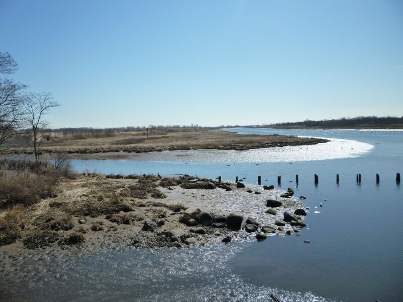
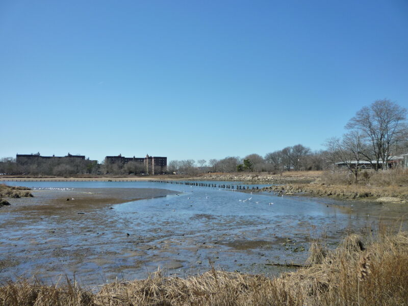
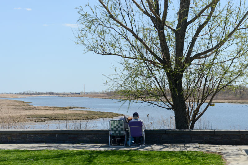
Marine Park surrounds the westernmost inlet of Jamaica Bay. The bay is one of several formed during the last 5000 years as ocean currents deposited sand in a series of long strips off the south shore of Long Island. These strips of beach form a barrier against the surf and allow salt marshes to grow in the calm water on their protected bay side.
Gerritsen Creek was a freshwater stream that once extended about twice as far inland as it does today. Around 1920 the creek north of Avenue U was converted into an underground storm drain. Yet it continues to supply the salt marsh with fresh water, which helps the marsh support a wide range of organisms. Broad expanses of fertile salt marsh, meadows adorned with wildflowers, sandy dunes held in place by beach plants, and jungle-like thickets of shrubs and vines dominate the landscape of Marine Park. Myrtle warblers, grasshopper sparrows, cotton-tailed rabbits, ring-necked pheasants, horseshoe crabs, and oyster toad fish are a small sampling of the animals that inhabit these plant communities and live in or around Gerritsen Creek.
The creek was probably a favorite hunting and fishing spot for Indians living in the nearby Keshawchqueren village. Archaeological excavations in Marine Park have revealed food preparation pits dating from 800 to 1400 A.D. and containing deer and turtle bones, oyster shells, and sturgeon scales. The first Europeans to settle here were the Dutch, who found the salt marshes and coastal plain of southern Brooklyn reminiscent of Holland's landscape. Their diet consisted of farm produce, livestock, game, and harvests of oysters and clams. Gerritsen Creek takes its name from Dutch colonist Wolfert Gerritsen, who built a gristmill on the creek in the latter half of the 17th century. The mill was in continuous operation until 1889, and it was destroyed by fire in 1935.
At the turn of the century developers began making elaborate plans to turn Jamaica Bay into a port, dredging Rockaway channel to allow large ships to enter the proposed harbor. Speculators anticipated a real estate boom and bought land along the Jamaica Bay waterfront. Fearing that the relatively pristine marshland around Gerritsen Creek would be destroyed, Frederick B. Pratt and Alfred T. White offered the city 150 acres in the area for use as a park in 1917.
After a seven-year delay the City accepted the offer. The prospect of a new park inspired developers to erect new homes in the area, although park improvements were slow to follow. Fill deposited in the marshlands in the 1930s and new land purchases increased the park's area to 1822 acres by 1937. That year the Board of Aldermen named the site "Brooklyn Marine Park." A series of additional land transactions, including the 1974 transfer of 1024 acres to the National Park Service for inclusion in the Gateway National Recreation Area, have stabilized the area of Marine Park at 798 acres, including land underwater.
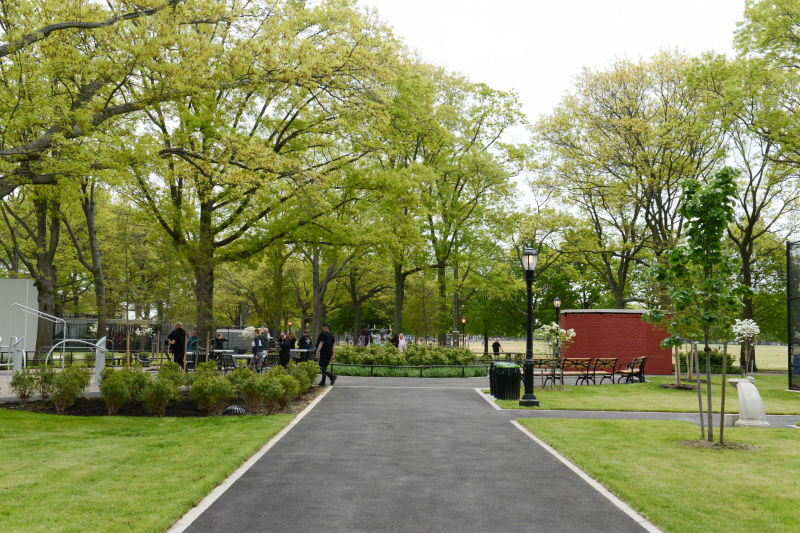
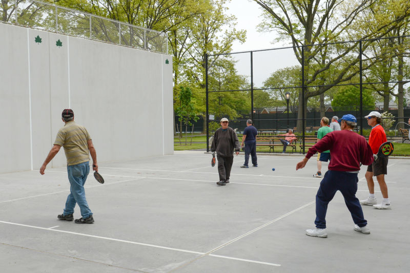
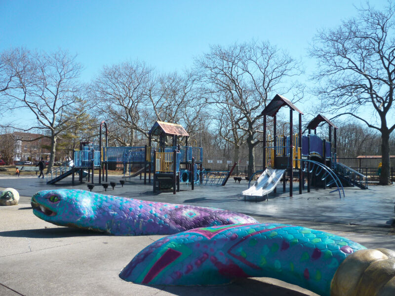
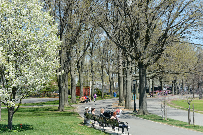
Over the past sixty years, portions of Marine Park have been improved with recreational facilities, while other areas have been conserved to protect wildlife and plant life. In 1939 the Pratt-White athletic field was dedicated in tribute to the two fathers of Marine Park. A 210-acre golf course opened in 1963, and the John V. Lindsay Model Airport was dedicated in 1971. New ballfields were opened in 1979 and named for baseball lover and police officer Rocco Torre in 1997. Nature trails established along Gerritsen Creek in 1984-85 invite parkgoers to observe a wealth of flora and fauna. Ongoing improvements at the end of the 20th century include the reconstruction of basketball, tennis, and boccie courts; of baseball fields; and of Lenape Playground at Avenue U. A new nature center opened in 2000.

Check out your park's Vital Signs
Clean & Safe
Green & Resilient
Empowered & Engaged Users
Share your feedback or learn more about how this park is part of a
Vital Park System![]()


%7Cutmcsr%3D(direct)%7Cutmcmd%3D(none)%3B%2B__utmv%3D89036315.-%3B)