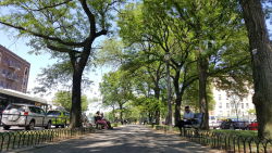
Crotona Parkway Malls
Crotona Pkwy bet. Bronx Park South and E 175 St
Bronx
Directions via Google Maps
What was here before?
This area was once the land of the Lenape which stretched from the Hudson Valley to Delaware. They used the nearby Bronx River which they called Aquahung. During the 19th century, this was the site of tenements, single family homes, and businesses. It was cleared away and the land was transferred to the city for purposes of a park.
How did this site become parkland?
The Crotona Parkway Malls were designed to follow Crotona Parkway for nine blocks between Crotona Park and Bronx Park. The parkway opened in 1910, replacing an earlier unpaved road known as Penfold Street. On the east side of the malls is Southern Boulevard, a grand thoroughfare built in the 1870s and extends from East 133rd Street and Third Avenue to the New York Botanical Garden.
Show Disclaimer
Highlights
Check out your park's Vital Signs
Clean & Safe
Green & Resilient
Empowered & Engaged Users
Share your feedback or learn more about how this park is part of a
Vital Park System

