Clove's Tail
Clove’s Tail
Clove’s Tail is so named for its location at the tail end of Clove Lakes Park. The Dutch word “kloven” translates as cleft in English, and here refers to the valley and brook lying between Emerson and Grimes Hills.
A massive ice sheet forced its way through this region 20,000 years ago; and as the ice receded northward, it dug valleys into the landscape. As ice melted, ponds and brooks were formed from the immense water run-off. One such brook originated in what is now Brooks Pond, and ran through this valley, ending in the Kill Van Kull channel that connects New York Bay with Newark Bay. This watercourse is known as Clove Brook. In pre-colonial Staten Island, Native Americans used a path adjacent to the stream as a route to Kill Van Kull.
As farmers and local residents dammed the brook for mills and other functions, small lakes and ponds were created at various points. By 1683, Governor Thomas Dongan (1634-1715) owned many acres in the northern section of the island, which he used as bear hunting grounds. He also built several dams across Clove Brook. These powered local mills that were used to grind grain and saw wood. Dongan’s nephews inherited the land, but one of them sold off much of it to finance his alcohol addiction. A later owner, Abraham Britton, built another dam and gristmill on the brook. The body of water created by this dam was called Britton’s Pond. One legend associated with Britton’s Pond concerns an Irish cowfrog weighing over 150 pounds. A favorite of local children and adults alike, the world’s largest frog eventually returned to Ireland after falling ill. His condition was most grim when his watermelon-sized warts had shrunk to the point of near invisibility. Apparently his native climate helped him gain back his weight, for the frog was said to have been in good health when later sighted near County Tipperary.
In 1926, severe floods destroyed Britton’s Mill and the dam was breached. Six years later, the Clove Lake Dam was built and Clove Lake formed where Britton’s Pond had been. The next pond to the north is Martling Pond, sometimes called Richmond Lake. It is formed by Martling Dam, which takes its name from the avenue that runs over it. The original dam at Martling Pond dated from the 1700s, but the floods of 1926 also destroyed it as well. The new dam was built in 1932, at the same time as the new dam at Clove Lake. The dam at Brook’s or Blake’s pond (the northernmost pond along Clove Brook) was badly damaged in 1882 and, like the others, completely destroyed in 1926. When it was rebuilt (along with the other two dams in 1932), it was dedicated in honor of the 200th anniversary of President George Washington’s (1732-1799) birthday. These are the three ponds that still remain in the area, but several other ponds have been connected to the brook, especially during the heyday of canals. These include Van Boskirk’s Pond (sometimes called Factory Pond), Bodine’s Pond, and Schoenein’s Pond, all of which dried up by the end of the 19th century.
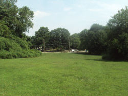
During the end of the 19th and early 20th century, this land switched hands between two families. Maps from 1874 show it as the property of the Gescheidt family. A map from 1907 shows a sixteen-acre estate owned by the Mathez family located here, on the corner of Clove Road and Little Clove Road. This estate was called “Clove Dale,” but a 1917 map shows that the land had reverted to the ownership of Henry Gescheidt. Parks acquired this land from the Evangelical Lutheran Church in 1954. The church had planned to build on the site, but thought that the eastern portion might be condemned for highway construction. To avoid complications, the church decided simply to sell the land. Neighborhood children now use this meadow as a free play space.
Check out your park's Vital Signs
Clean & Safe
Green & Resilient
Empowered & Engaged Users
Share your feedback or learn more about how this park is part of a
Vital Park System


