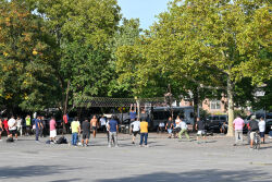
What was here before?
From colonial times until the early 1900s, the area now known as Jackson Heights was a large marsh called Trains Meadow. As NYC grew more densely populated, a housing shortage emerged. In 1909, Edward A. MacDougall's Queensboro Corporation purchased 325 acres of undeveloped land and named it Jackson Heights, after John C. Jackson, a notable Queens entrepreneur. The area, initially low-lying, was raised to avoid flooding and became the highest point in the area. "Heights" was added to signal the neighborhood's exclusivity, drawing inspiration from Brooklyn Heights. Initially accessible by ferry, the neighborhood became more reachable with the opening of the Queensboro Bridge in 1909, followed by the 7 train in 1917 and double-decker buses in 1922.
Show Disclaimer
Check out your park's Vital Signs
Clean & Safe
Green & Resilient
Empowered & Engaged Users
Share your feedback or learn more about how this park is part of a
Vital Park System


