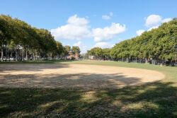
What was here before?
The Lenape originally used this area for hunting and fishing given its proximity to Jamaica Bay's rich ecosystem. The Dutch arrived in the 1630s, purportedly purchasing the land from its Indigenous inhabitants, who did not practice land ownership and likely thought they were just allowing the early settlers to use the land. Shortly after, the Lenape were eradicated from what became known as Nieuw Amersfoort to the Dutch and later Flatlands to the English.
The area remained rural farmland for centuries. By the mid-1800s, this parcel was part of an estate owned by James Ditmars, an heir of the prominent Kings County family with substantial landholdings in Flatlands since the colonial period. The property was undeveloped through the first half of the twentieth century.
Show Disclaimer
Highlights
Check out your park's Vital Signs
Clean & Safe
Green & Resilient
Empowered & Engaged Users
Share your feedback or learn more about how this park is part of a
Vital Park System


