Archaeological Discovery at Burling Slip
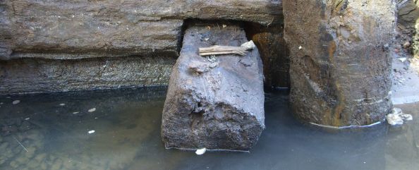
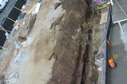
Imagination Playground is located within an open space known as Burling Slip. Slips (or docking basins) are the areas between wharves, which provide a place for ships to load and unload cargo. While digging to build the foundations of Imagination Playground in May 2009, archaeologists and construction workers uncovered the remains of two buried wharves.
Discovering the Wharves
The first discovery, a 190-foot section of Codwise’s Wharf, was found along the eastern edge of John Street, which was built in stages between 1803 and 1807 by George Codwise Jr., a prominent New York merchant. The corner of a second wharf, Remsen’s Wharf, probably built about ten years earlier, was discovered near the corner of Burling Slip and Front Street.
History of Burling Slip
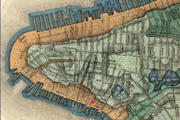
At the time of the first European contact, the East River shoreline in this area was located about one and a half blocks north of Front Street and the entirety of what is now Burling Slip was under water. The shoreline was characterized by an almost continuous network of wharves and slips, was built increasingly further out into the East River, responding to pressures for new commercial real estate and in order to address the poor conditions of the existing waterfront infrastructure.
As the leading port in New York City, the South Street Seaport was an international center of commerce by the mid-nineteenth century. Burling Slip, like the shoreline that surrounded it, was filled and extended increasingly further into the East River in several construction episodes, the earliest of which occurred in the seventeenth century.
Remsen's Wharf and Codwise's Wharf
The portion of Burling Slip that is now the site of Imagination Playground functioned as a docking basin during the first half of the nineteenth century. It served ships docked at Remsen’s Wharf and subsequently Codwise’s Wharf to the east. Many of the buildings currently standing along Burling Slip, including those now housing the Seaport Museum, were built on Codwise’s Wharf. When first constructed, the buildings looked out onto the open water of Burling Slip, where merchant ships docked to load and unload cargo. Burling Slip basin was filled in around 1840, and the adjacent wharves were extended further into the East River.
The Archaeological Findings
Collecting Early Garbage
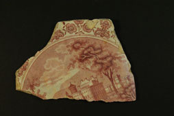
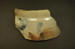
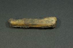
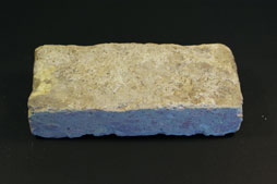
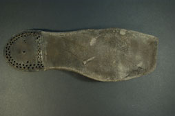
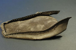
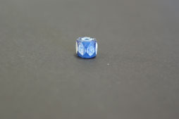
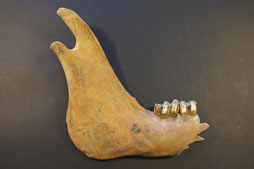
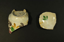
When the shoreline was extended around 1840, Burling Slip was filled in with loose sand, soil, and trash. During the excavation, archaeologists collected many pieces of this early garbage to get a better understanding of what kinds of things were being used and discarded in the neighborhood in the mid-1800s. Some artifacts discovered at Burling Slip were food remains, such as animal bones. Broken ceramics were also found, ranging from transfer-print plates to hand-painted cups and locally made stoneware. Some of these ceramics may have been part of a damaged shipment, thrown into the slip straight from the ship, while others may have represented locally generated refuse. Many shoes and shoe fragments were found at Burling Slip. Shoes are often found at landfill sites in Lower Manhattan and are probably refuse from a nearby shoe-selling district.
Examining the Wharves
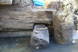
Archaeologists also studied the wooden wharf structures themselves. They documented their construction characteristics and used dendrochronology (tree ring analysis) to determine the age and geographic origin of the timbers that comprised the wharf. Codwise’s and Remsen’s Wharves were built of hand-hewn squared pine and hemlock timbers from the Hudson Valley. The timbers were stacked horizontally, one on top of another, and notched together in a manner similar to how the walls of a log house are built. This technique was a typical way of building wharves in North America from the early 18th through the late 19th centuries. Codwise’s Wharf was somewhat unusual in that it was built in sections of linear bulkhead, instead of the more typical box-like crib form. Archaeologists believe that Codwise chose this technique because it allowed him to start construction before he had obtained permission to build on all of the necessary underwater lots.
Click on any image to view larger and see additional information
About the Investigation
The Burling Slip project was undertaken by the City of New York and made possible by a grant from the Lower Manhattan Development Corporation (LMDC), which is funded through Community Development Block Grants from the U.S. Department of Housing and Urban Development. AKRF, Inc. performed the archaeological investigations under the guidance of the New York State Historic Preservation Office and the New York City Landmarks Preservation Commission. The wharf structures found at Burling Slip were researched, documented, and wherever possible, preserved in place beneath the playground. The artifact collection is currently housed at the New York City Archaeological Repository. For more information about the archaeological investigation, please read the Bulkhead Documentation Report, prepared by AKRF, Inc.
