
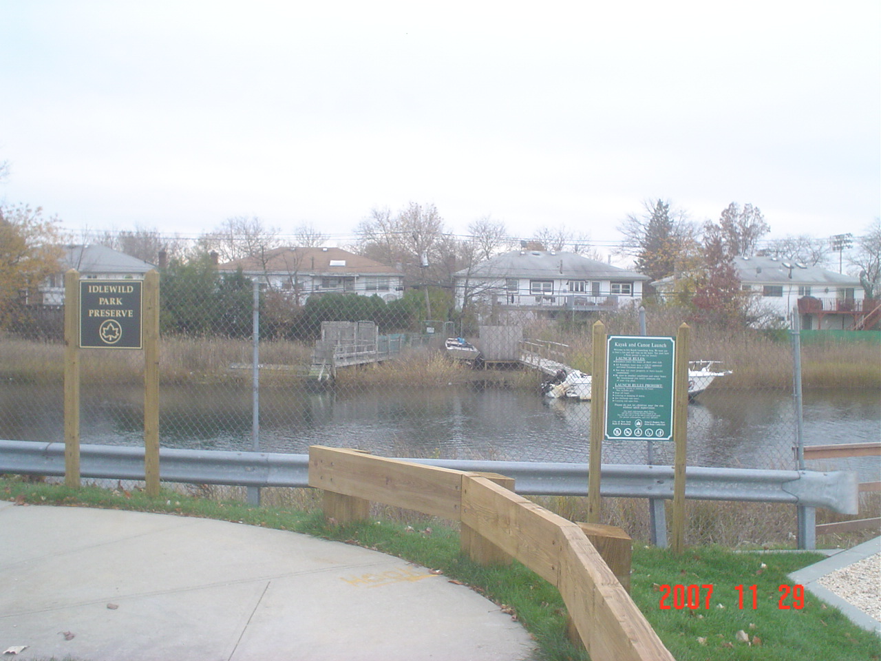
Idlewild
Craft Avenue & Huxley Street
9:00 a.m. - 9:00 p.m. Monday to Friday
Rules Prohibit:
- Swimming, diving, or bathing
- Rafts or other inflatables
- Consumption of alcohol
- Littering
- Smoking
- Any discharge into water
- Pets off leash or in the water
- Open flame
- Storing personal property
- Motor vehicles without specific authorization
Location Details
Launch: No
Landing: No
Site Fee: No
ADA Accessible: No
Rental: No
Storage: No
Rest Area: No
Parking: Yes
Portage: 200 ft.
Images:


Nearby Locations
By Car
Conduit South, Right turn onto Guy Brewer Blvd. heading S/E, left turn onto 147 Avenue heading East, Right turn onto Huxley, end near Craft.
By Mass Transit
From Manhattan: E/J Train Outbound to Jamaica Center/Parsons/Archer exit. Transfer to the Q111 bus to Rosedale, exit at Huxley Street. Walk South on Huxley Street towards 147th Road.
From the Bronx: 6 train to 1st Street in Manhattan, transfer to the E train and follow directions from Manhattan.
From Brooklyn: A train towards toward Far Rockaway, exit Far Rockaway/Mott Avenue, Walk West towards Redfern Avenue. Take Q113bus towards Jamaica, exit at 148th Road. Walk East on 148th Road towards 241st. Turn Right Edgewood Street. Turn left on 149th Avenue. Turn Right on Huxley.
From Staten Island: X1 Express bus toward Manhattan. Exit at Park Street. Transfer to the A train and follow the directions from Brooklyn.
From Queens: Q111 Bus towards Rosedale.
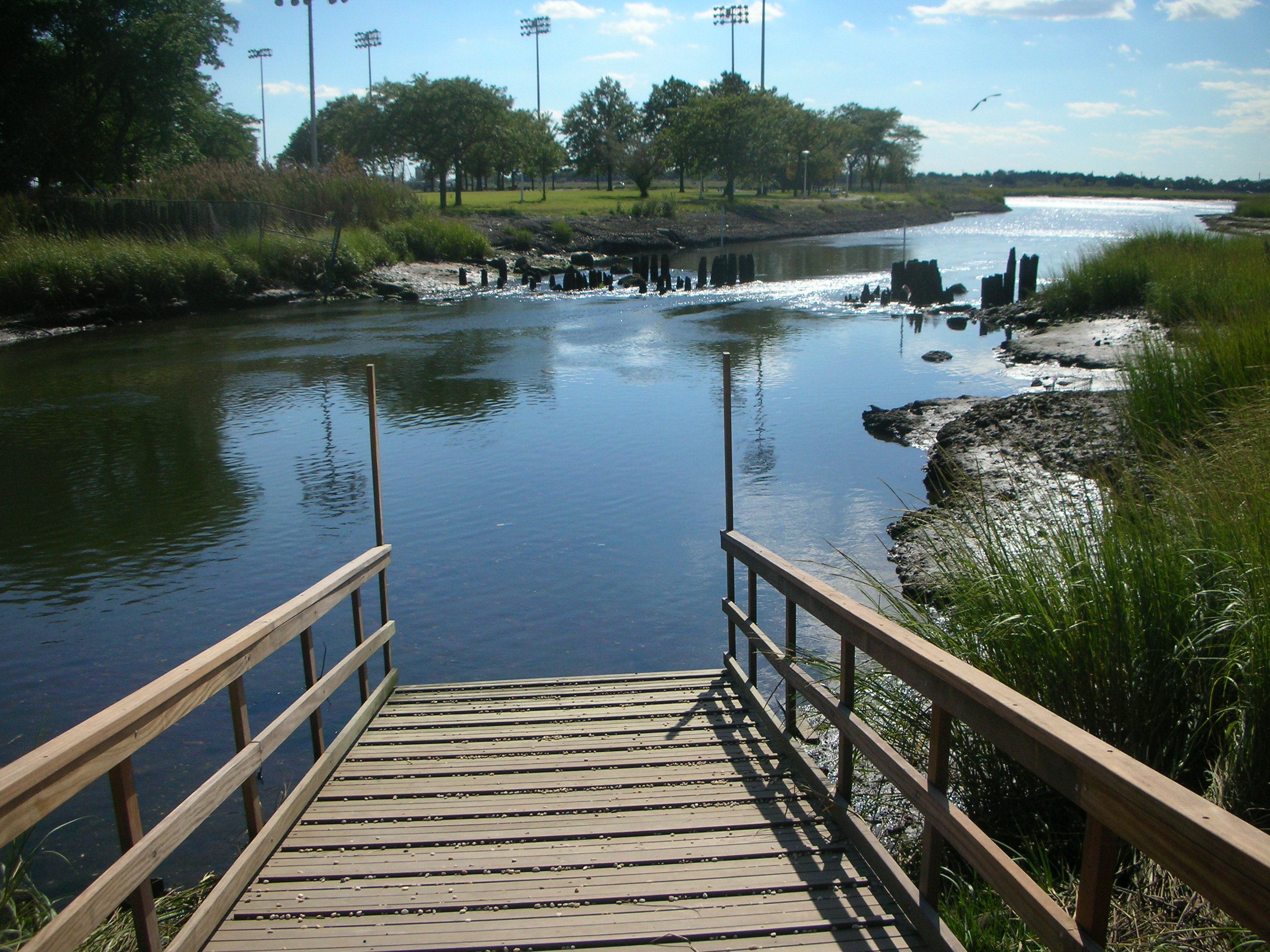
The day would begin about an hour or two before high tide, enabling easy launch, problem-free navigation throughout the wetlands, and hen easy extractions from the water upon return to the dock. Upon entering the creek area, paddlers have two options: they can choose to head off to the west, weaving their way around a series of small marsh islands, or they can choose to head south to the open body of water, working their way around the shoreline. The marsh area does not take more than 20 minutes to navigate, so visiting both venues is a reasonable goal. During the trip paddlers would see Osprey overhead, as a pair currently nests on a tall light fixture located about 200 feet east of the launch site, as well as many varieties of crab, from blue-clawed to horseshoe. Many wading birds would also be spotted, from yellow and black-crowned night herons, to snowy and great egrets, to great blue herons and a variety of gulls. Due to the changing tides, navigation throughout the preserve should last no more than three hours, as a trip any long would make returning to the launch site a bit difficult. This launch is intended for intermediate paddlers.
Sanctuaries
Dubos Point Wildlife Sanctuary, Jamaica Bay Wildlife Sanctuary
No Access Areas
JFK International Airport
Restrictive Conditions
N/A
Hazardous Launch/Landing Conditions
Very slippery when wet and pebbles on ramp can be a problem
Currents
Currents coming from Jamaica Bay can push or pull a boater depending on whether it’s becoming high or low tide; boats can also become grounded along shoreline during low tide.
Emergency Landing Points
Launch into a narrow creek with shoreline on both sides that could be used as an emergency landing. The shoreline along the creek is no more than 30 feet away at anytime. When out in the open water, shoreline is at least 150 feet away.
Nearest Hospitals
1) South Nassau Communities Hospital located at 1420 Broadway in Hewlett, New York, (516) 374-8631
2) Saint John’s Episcopal Hospital located at 327 B 19th Street in Far Rockaway, NY (718) 869-7000.
%7Cutmcsr%3D(direct)%7Cutmcmd%3D(none)%3B%2B__utmv%3D64667637.-%3B)