The Earliest New York City Parks
The Department of Parks & Recreation has a long history of serving the public with clean and safe spaces to relax and recreate, but parks and open spaces existed in New York long before the first "Department of Public Parks" was established in 1870. The earliest parks date to the Dutch and Colonial era, and parks before 1856 were maintained by the Mayor's office and street commissioner. But as the city grew and open space diminished, it became important to reserve open space for the city's citizenry. In 1856, a new era of park planning emerged when the Board of Commissioners of Central Park was established to build that great landmark. The Board also built parks in Harlem (Jackie Robinson, Marcus Garvey, Morningside and St. Nicholas Parks), and in 1870, a Parks Department similar to what we have today was established to oversee all parks in the city; that there was an entire city department for parks shows the importance of parks in the late 19th century.
European Roots
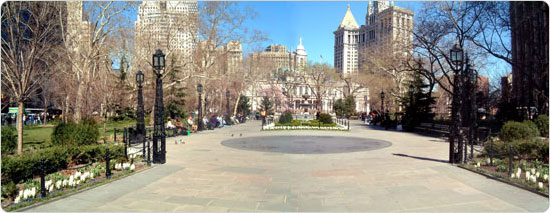
The concept of the village green was common in Europe for centuries, and Europeans settlers frequently built early American towns around a town green or commons area. When the Dutch and later the English settled at the southern tip of Manhattan in the 17th century, a communal pasture existed south of Collect Pond known as the "Vlackte" or "Flats" that was also used for executions and the burial of paupers and slaves — a portion of this spot survives as City Hall Park. In the early years of the Dutch West India Company enterprise in New Amsterdam, the area now known as Bowling Green served as a market place and parade ground. The site survives today, in continuous use for almost 400 years.
On April 27, 1686, Governor Thomas Dongan issued an early city charter that enumerated the responsibilities of the Colonial government. The Dongan Charter of the City of New York officially put all "waste, vacant, unpatented and unappropriated lands" for the first time in municipal care, under the jurisdiction of the Common Council. These "unappropriated lands" included the outdoor marketplaces and public commons that later became the first city parks. In addition to Bowling Green and City Hall Park, the Battery, at the southern tip of Manhattan, served as an open area for the batteries of cannon that gave the park its name. The City's ownership of all these parks is traced back to the Dongan Charter.
Gathering Grounds
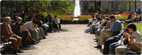
These early parks were centers of early New York life. Bowling Green sits at the beginning of Heere Staat, or High Street —now Broadway — the important trade route that extended north through Manhattan and the Bronx. Broadway also runs by City Hall Park's western boundary. In 1765, New Yorkers protested the Stamp Act at City Hall Park, and a year later the first "Liberty Pole," a commemorative mast topped by a vane featuring the word "liberty," was built by pro–independence New Yorkers (a replica dating to 1921 now stands between City Hall and Broadway, near its original location).
During the American Revolution (1776–1783) the British controlled New York and used a debtor's prison on the site to hold Revolutionary prisoners of war, executing 250 of them on gallows located behind barracks there. When the Declaration of Independence was read in City Hall Park on July 9, 1776, a raucous crowd proceeded down Broadway to Bowling Green Park and toppled the statue of George III, hacking it to pieces to be recast as musket balls. City Hall Park was improved with trees and grass after 1784, and by 1803 the popular commons and gathering place was referred to as "The Park."
New Yorkers continued to use City Hall Park for gatherings and events throughout the 19th century, including public meetings after the declaration of the Mexican–American War in 1846, and a call to volunteers in 1862 to enlist in the Civil War (1861–1865). U.S. Presidents Andrew Jackson, Andrew Johnson, Benjamin Harrison and Jimmy Carter all visited City Hall during their presidencies. And after President Lincoln was assassinated, his funeral procession for New York residents originated at City Hall.
An Important Base
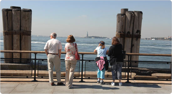
Located at the southern tip of Manhattan with ready access to the harbor and the Hudson River, Battery Park is where the history of New York City began. The area's strategic location was recognized by Native Americans and Dutch settlers, who called it Capske Hook (from Kapsee, an Indian term for rocky ledge). Near this point, the colonists of the Dutch West India Company began the settlement of New Amsterdam in 1625. Both the Dutch and English used the site for military installations to defend the island in New York's early years. Battery Park's promenade and view of the harbor made it a popular place for New Yorkers to visit in the early 18th century, and, over time, the harbor was filled in to give parkgoers more room. (In 2005, work on the new South Ferry subway station uncovered evidence of 18th century sea walls that will be preserved in some capacity.) George Washington mentioned frequent walks "round the Battery" in the diaries he kept during his time in New York at the beginning of the new republic.
In the 19th century, the circular fort known as Castle Clinton was converted to a setting for countless receptions, demonstrations, and performances. U.S. Presidents were feted at "Castle Garden," among them John Tyler, James K. Polk, Franklin Pierce, and Andrew Jackson (as well as his vice president Martin Van Buren, who would go on to become president). The Marquis de Lafayette was welcomed there in 1824 and Hungarian patriot Lajos Kossuth visited in 1851. Inventor Samuel F.B. Morse demonstrated his "wireless telegraph" at Castle Garden in 1842. From 1855 to 1890, the building was used as the federal immigration center for the east coast, processing approximately eight million immigrants.
Bowling Green Park became more of an "official" park — perhaps the first city park — when it was established by the Common Council on March 12, 1733 (2008 marks its 355th anniversary). Bowling Green was an early public-private partnership — it was leased at an annual rent of one peppercorn to John Chambers, Peter Bayard, and Peter Jay, who were responsible for improving the park with grass, trees, and a wooden fence "for the Beauty and Ornament of the Said Street as well as for the Recreation & Delight of the Inhabitants of this City." A gilded lead statue of George III, commissioned by grateful New York City merchants after the repeal of the Stamp Act, was the first statue in a city park when it was erected in the center of Bowling Green Park in 1770. In 1771, a wrought iron fence was erected around the irregular oval of the Bowling Green to protect the park and its royal monument; the fence survives and is a designated New York City Landmark.
Transformed Space
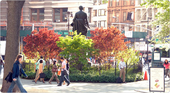
Many open spaces we now know as parks were originally used for other purposes. Property along Minetta Brook in Greenwich Village was acquired by the city in 1797 for a potter's field. In 1823, the cemetery was closed, and the area was declared a public square known as Washington Parade Ground, or Washington Square. Bryant Park was once a reservoir until it opened officially in 1847. And Madison Square Park was officially opened in 1847, only after the demolition of the state arsenal (constructed there in 1806) was completed. Another early Manhattan park, Beach Street Park at the intersection of Beach, Walker, and Chapel (now West Broadway), was purchased by the city in 1810. Jackson Square Park is another one of New York City's oldest parks. The park is situated along Greenwich Avenue, the oldest known road in Greenwich Village. This plaza consists of two parcels of land, each with a distinct origin and history of uses. Elsewhere in Manhattan, Coenties Slip (Vietnam Veterans Plaza) first served as boat slip, and then open space after it was filled in 1835.
Buying and Building
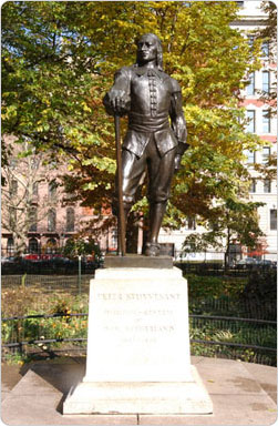
Stuyvesant Square, which opened as a public park in 1850, has a direct link to New York's early history. In 1836, Peter Gerard Stuyvesant and his wife Helen Rutherford reserved four acres of the family farm and sold it for five dollars to the City of New York as a public park. The Stuyvesant family farm dated to the 1660s when Stuyvesant's relative Peter Stuyvesant — the last Dutch Director–General of the colony of New Netherland — established it in the wilderness beyond the village on the tip of the island. Today, Stuyvesant Square is nestled in the middle of busy Manhattan, open space for the entire history of the city, and visitors to the site experience a direct link to the island's past. (New Netherland Director–General Stuyvesant is commemorated at the site with a bronze sculpture.)
The first public space acquired by the City specifically for use as a public park was Duane Park, located at Hudson and Duane Streets in Manhattan. Trinity Church sold the triangle of land to the City for five dollars in 1797, on the condition that it be fenced and landscaped "as promotive of health and recreation."
The Commissioners' Plan of 1811, which mapped out the streets of Manhattan, designated several spots as open space, including Union Square, Tompkins Square Park, Madison Square Park and Marcus Garvey Parks; in general, early plans allotted more space for these sites than what was finally built. Also, some parks that once existed were eventually eliminated. One, an ornate and elegant square known as Hudson Square or St. John's Park, appeared on Manhattan maps as early as 1797 and existed at what is now the southern exit of the Holland Tunnel until the City sold the land to Cornelius Vanderbilt, who built the Hudson River Railroad Freight Depot there in 1867.
The Village of Brooklyn was incorporated as a city in 1834, which gave it increased powers to lay out squares and parks. The first park in Brooklyn was "City Park," now known as Commodore Barry Park, established in 1836. By 1839, a board of commissioners had presented a city plan with 11 planned parks and squares including Washington (Fort Greene) and Tompkins (Von King) Parks. Although not a city park, the Green–Wood Cemetery, which opened in 1840, provided the public 478 landscaped acres and 20 miles of pedestrian paths. The cemetery introduced the public to the amenities of the landscaped "pleasure ground," and led in part to the creation of Prospect Park. Carroll Park in Carroll Gardens is another early Brooklyn site; its origins date to the 1840s when it was established as a private community garden after much of the neighborhood (which now comprises the Carroll Gardens Historical District) was laid out by surveyor Richard Butt. The land was acquired for use as a public park by the City of Brooklyn in 1853.
Fort Greene Park had been the site of military installations from the days of the Revolutionary War. After the War of 1812, locals enjoyed visiting the grounds of the old fort for recreation and relaxation. Fort Greene Park was established by the City of Brooklyn in 1847, successfully concluding a long struggle led by Walt Whitman, editor of the Brooklyn Eagle, for more parks in Brooklyn. Tompkins Park, originally named for New York Governor and U.S. Vice President Daniel D. Tompkins, was acquired by the City of Brooklyn in 1857.
The population of Brooklyn had risen from 48,000 in 1840 to almost 280,000 in 1859. For years, Brooklynites had wanted more parks to relieve what Walt Whitman had described as the "swarmingness of the population." In 1859, the State Legislature appointed a Brooklyn Board of Park Commissioners who, a year later, proposed a site for Prospect Park. In 1865, Olmsted and Vaux were hired to design the park and supervise its construction. Partly because Olmsted and Vaux were able to define the park's size, shape, and location more completely in this second major commission, Prospect Park has often been cited as the purest example of their art.
In Queens, the oldest parks are Daniel Carter Beard Memorial Square (known as Flushing Park until 1942), which was acquired by the town of Flushing in 1875, and Wayanda Park, which was acquired by the town of Jamaica in 1844. Wayanda Park, named for the Native American word for "The Place of Happy Hearts," was once used as a burial ground or potter's field.
The first public space acquired by the City specifically for use as a public park was Duane Park, located at Hudson and Duane Streets in Manhattan. Trinity Church sold the triangle of land to the City for five dollars in 1797, on the condition that it be fenced and landscaped "as promotive of health and recreation." The Commissioners' Plan of 1811, which mapped out the streets of Manhattan, designated several spots as open space, including Union Square, Tompkins Square Park, Madison Square Park and Marcus Garvey Park; in general, early plans allotted more space for these sites than what was finally built. Also, some parks that once existed were eventually eliminated. One, an ornate and elegant square known as Hudson Square or St. John's Park, appeared on Manhattan maps as early as 1797 and existed at what is now the southern exit of the Holland Tunnel until the City sold the land to Cornelius Vanderbilt, who built the Hudson River Railroad Freight Depot there in 1867.
The Village of Brooklyn was incorporated as a city in 1834, which gave it increased powers to lay out squares and parks. The first park in Brooklyn was "City Park," now known as Commodore Barry Park, established in 1836. By 1839, a board of commissioners had presented a city plan with 11 planned parks and squares including Washington (Fort Greene) and Tompkins (Von King) Parks. Although not a city park, the Green–Wood Cemetery, which opened in 1840, provided the public 478 landscaped acres and 20 miles of pedestrian paths. The cemetery introduced the public to the amenities of the landscaped "pleasure ground," and led in part to the creation of Prospect Park. Carroll Park in Carroll Gardens is another early Brooklyn site; its origins date to the 1840s when it was established as a private community garden after much of the neighborhood (which now comprises the Carroll Gardens Historical District) was laid out by surveyor Richard Butt. The land was acquired for use as a public park by the City of Brooklyn in 1853.
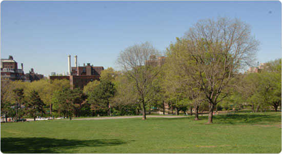
Fort Greene Park had been the site of military installations from the days of the Revolutionary War. After the War of 1812, locals enjoyed visiting the grounds of the old fort for recreation and relaxation. Fort Greene Park was established by the City of Brooklyn in 1847, successfully concluding a long struggle led by Walt Whitman, editor of the Brooklyn Eagle, for more parks in Brooklyn. Tompkins Park, originally named for New York Governor and U.S. Vice President Daniel D. Tompkins, was acquired by the City of Brooklyn in 1857.
The population of Brooklyn had risen from 48,000 in 1840 to almost 280,000 in 1859. For years, Brooklynites had wanted more parks to relieve what Walt Whitman had described as the "swarmingness of the population." In 1859, the State Legislature appointed a Brooklyn Board of Park Commissioners who, a year later, proposed a site for Prospect Park. In 1865, Olmsted and Vaux were hired to design the park and supervise its construction. Partly because Olmsted and Vaux were able to define the park's size, shape, and location more completely in this second major commission, Prospect Park has often been cited as the purest example of their art.
In Queens, the oldest parks are Daniel Carter Beard Memorial Square (known as Flushing Park until 1942), which was acquired by the town of Flushing in 1875, and Wayanda Park, which was acquired by the town of Jamaica in 1844. Wayanda Park, named for the Native American word for "The Place of Happy Hearts," was once used as a burial ground or potter's field.
The oldest park on Staten Island is Veterans Park in Port Richmond, which was laid out in 1836 as Port Richmond Park when Port Richmond's village streets were mapped and the site designated as the village green.
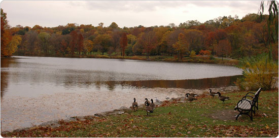
The earliest parks in the Bronx are more recent, owing to the borough's later development. The Bronx parks are important, however, in that they comprise a total park system, as opposed to the haphazard way parks took shape in early Manhattan. In 1881, John Mullaly (honored by Mullaly Park in the Bronx), formed the city's first open–space advocacy organization, the New York Park Association, to advocate for the acquisition of nearly 4,000 acres above the Harlem River. The Association helped secure State legislation in 1883 to establish six large parks and three broad parkways. On December 12, 1888, Bronx, Claremont, Crotona, St. Mary's, Van Cortlandt and Pelham Bay Parks, as well as Crotona, Mosholu and Bronx-Pelham Parkways, were vested to the City of New York, quintupling the City's green space overnight.
- Bronx Park, 1888
- Claremont Park, 1888
- Crotona Park, 1888
- St. Mary's Park, 1888
- Van Cortlandt Park, 1888
- Pelham Bay Park, 1888
- Commodore Barry Park, 1836
- Fort Greene Park, 1847
- Carroll Park, 1853
- Von King (Tompkins) Park, 1857
- Prospect Park, 1859
- Bowling Green, 1733
- Beach Street Park, 1810
- Jackson Square, ca.1811
- Ahearn Park, 1825
- Cooper Park, 1828
- Abingdon Square, 1831
- Tompkins Square, 1834
- Coenties Slip/Vietnam Veterans Plaza, ca. 1835
- Christopher Park, 1837
- Union Square, 1839
- Herald/Greeley Squares, 1846
- Bryant Park, 1847
- Stuyvesant Square, 1850
Related Information
Before They Were Parks Online Historic Tour Presidents in Parks